Disclosure : This site contains affiliate links to products. We may receive a commission for purchases made through these links.
Mammals of the British Isles: Handbook


Related Products:
 The Walker`s Handbook: Everything You Need to Know About Walking in The British Isles
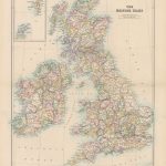
 British Isles: Stanfords Map of the British Isles c.1859 SMALL
 The Historical Atlas of the British Isles
 British Isles Physical c.1900
 C80 British Isles
 British Isles Explorer
 Sea Charts of the British Isles
 British Isles Since 1945
 Hitler`s British Isles
 British Isles Geological SMALL
British Isles Geological MEDIUM
British Isles Geological SMALL
British Isles Geological MEDIUM
 Cols and Passes of the British Isles
 Environment of the British Isles Atlas
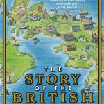 The Story of the British Isles in 100 Places
 A Cheesemonger`s History of The British Isles
 Willdey`s British Isles 1715
 British Isles Communication OS Wall Map LAMINATED
British Isles Political Wall Map PAPER
British Isles Communication OS Wall Map LAMINATED
British Isles Political Wall Map PAPER
 British Isles: Industries & Communications c.1900
 The Lie of the Land – An Under the Field Guide to the British Isles
 Narrow Gauge Lines of the British Isles
 Caravan & Camping British Isles: 2015
 British Isles Etymological Map (Atlas of True Names)
 British Isles Maps International Planning Map PAPER
 Walking with Plato: A Philosophical Hike Through the British Isles
 German Invasion Plans For the British Isles (1940)
 British Isles Political Wall Map SMALL ENCAPSULATED
 Island Gardens: Havens of Beauty Around the British Isles
 British Isles Map Marketing Route Planning Wall Map ENCAPSULATED
 Stanford`s Folio British Isles Map (1884) – A4 Wall Map, Paper
Stanford`s Folio British Isles Map (1884) – A4 Wall Map, Canvas
Stanford`s Folio British Isles Map (1884) – A3 Wall Map, Paper
Stanford`s Folio British Isles Map (1884) – A2 Wall Map, Canvas
Stanford`s Folio British Isles Map (1884) – A1 Wall Map, Paper
Stanford`s Folio British Isles Map (1884) – A1 Wall Map, Canvas
British Isles Global Mapping Political Wall Map ENCAPSULATED
Stanford`s Folio British Isles Map (1884) – A4 Wall Map, Paper
Stanford`s Folio British Isles Map (1884) – A4 Wall Map, Canvas
Stanford`s Folio British Isles Map (1884) – A3 Wall Map, Paper
Stanford`s Folio British Isles Map (1884) – A2 Wall Map, Canvas
Stanford`s Folio British Isles Map (1884) – A1 Wall Map, Paper
Stanford`s Folio British Isles Map (1884) – A1 Wall Map, Canvas
British Isles Global Mapping Political Wall Map ENCAPSULATED
 Orchid Summer: In Search of the Wildest Flowers of the British Isles
 The Wild Isles: An Anthology of the Best of British and Irish Nature Writing
Holidays in the British Isles 2013: A Guide for Disabled People
The Wild Isles: An Anthology of the Best of British and Irish Nature Writing
Holidays in the British Isles 2013: A Guide for Disabled People
 From Epsom to Tralee: A Journey Round the Racecourses of the British Isles