Disclosure : This site contains affiliate links to products. We may receive a commission for purchases made through these links.
Malvern: The Wyche 1926
Malvern: The Wyche in 1926 in a fascinating series of reproductions of old Ordnance Survey plans in the Alan Godfrey Editions, ideal for anyone interested in the history of their neighbourhood or family. The map covers part of Great Malvern with the northern tip of Malvern Wells. Coverage runs from the Worcestershire Beacon southward to Upper Wyche. Herefordshire area is left blank. Features include Lower Wyche and Upper Wyche, All Saints church, Railway Inn, quarries, gold mine, Royal Well Mineral Water Works, Worcestershire Beacon, Firs Valley, Malvern Common, The Firs, Emmanuel Church, Hampton House, Mathon Lodge, etc. About the Alan Godfrey Editions of the 25″ OS Series:Selected towns in Great Britain and Ireland are covered by maps showing the extent of urban development in the last decades of the 19th and early 20th century. The plans have been taken from the Ordnance Survey mapping and reprinted at about 15 inches to one mile (1:4,340). On the reverse most maps have historical notes and many also include extracts from contemporary directories. Most maps cover about one mile (1.6kms) north/south, one and a half miles (2.4kms) across; adjoining sheets can be combined to provide wider coverage.FOR MORE INFORMATION AND A COMPLETE LIST OF ALL AVAILABLE TITLES PLEASE CLICK ON THE SERIES LINK.

Related Products:
 Great Malvern and West Malvern 1926
Malvern Link 1926
Great Malvern East 1926
Malvern Wells 1903
Great Malvern and West Malvern 1926
Malvern Link 1926
Great Malvern East 1926
Malvern Wells 1903
 Hunmanby 1926
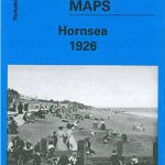 Hornsea 1926
Bewdley 1926
Bromsgrove 1926
Hornsea 1926
Bewdley 1926
Bromsgrove 1926
 Urmston 1926
Lower Irlam and Cadishead 1926
Tettenhall 1900
Stourport 1901
Urmston 1926
Lower Irlam and Cadishead 1926
Tettenhall 1900
Stourport 1901
 Mitcham 1910
Wollaston 1901 – 4.09
Irlam Hall 1926
Mitcham 1910
Wollaston 1901 – 4.09
Irlam Hall 1926
 Great Driffield 1909
Tiverton 1903
New Quay 1904
Bearwood 1903
Quinton 1902
Swanage 1900
Great Driffield 1909
Tiverton 1903
New Quay 1904
Bearwood 1903
Quinton 1902
Swanage 1900
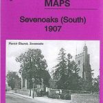 Sevenoaks South 1907
Gateshead Fell & Sheriff Hill 1895 – 7.05a
Honiton 1903
Dundonald 1902
Sevenoaks South 1907
Gateshead Fell & Sheriff Hill 1895 – 7.05a
Honiton 1903
Dundonald 1902
 Shortlands 1894
 Sevenoaks North and Riverhead 1907
Mouth of the Tyne 1895
Sevenoaks North and Riverhead 1907
Mouth of the Tyne 1895
 Croydon NW 1895 – 154
 Upper Edmonton 1894 – 3a
Eston 1927
Langley and Londonderry 1902
East Jarrow 1913
Upper Edmonton 1894 – 3a
Eston 1927
Langley and Londonderry 1902
East Jarrow 1913
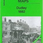 Dudley 1882 – 67.16a Coloured Edition
Willesden and Stonebridge Park 1936
Jarrow 1912
Criccieth 1913
Dudley 1882 – 67.16a Coloured Edition
Willesden and Stonebridge Park 1936
Jarrow 1912
Criccieth 1913
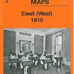 Ewell West 1910
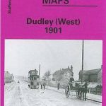 Dudley West 1901
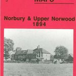 Norbury and Upper Norwood 1894