Disclosure : This site contains affiliate links to products. We may receive a commission for purchases made through these links.
Mallorca Editorial Alpina Cycling Map

Mallorca at 1:100,000 on a double-sided cycling map from Editorial Alpina printed on light, waterproof and tear-resistant plastic paper. Roads are classified according to density of traffic and six route profiles are included.The map is double-sided, dividing the island east-west with a small overlap between the sides. Topography is shown by altitude colouring with spot heights and roads are annotated with gradient markings giving the percentage of incline.Roads likely to be used by cyclists are classified according to the density of traffic: light, medium and heavy. Additional annotations provide information for particular sections, e.g. heavy traffic during certain parts of the day/week, tunnel without lights, etc. Nine routes, from 36km to 141km long are provided with 10km/100m of altitude profiles. Also marked are selected mountain bike trails which connect to the road network.The map also shows locations of bike hire and repairs shops (contact details are provided), selected bars and restaurants, viewpoints, places of interest, etc. UTM grid is printed at 10 km intervals.Map legend and all the relevant text include English.

Related Products:
 Mallorca North Walking & Cycling Map & Guide Editorial Alpina
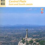 Mallorca Central Plain – East and South Coasts Editorial Alpina
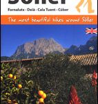 Sรณller – Mallorca Editorial Alpina Map & Guide ENGLISH
 Caps del Nord – Mallorca Editorial Alpina 2-Map Set
 Mallorca East Reise Know-How
 Mallorca South Reise Know-How
 Mallorca North Reise Know-How
 Mallorca West Reise Know-How
 Menorca – Camรญ de Cavalls – GR223 Editorial Alpina CATALAN
 Mallorca Kompass 2-Map Cycling Set 3500
 Mallorca – Tramuntana South Editorial Alpina
 Mallorca – Tramuntana Central Editorial Alpina
 Mallorca – Tramuntana North Editorial Alpina
Spain: Reise Know-How Walking and Touring Maps of Mallorca
Mallorca – Tramuntana North Editorial Alpina
Spain: Reise Know-How Walking and Touring Maps of Mallorca
 Belgium and Neighbouring Regions: Sportoena 50K Cycling Maps
 Menorca – Camรญ de Cavalls – GR223 Editorial Alpina ENGLISH
 Ibiza – Formentera Editorial Alpina
 Pyrenees 350K Editorial Alpina Road Map
 Val d`Aran – Mauberme – Montardo – Molieres Editorial Alpina
 Mallorca – 60 Easy Hikes Editorial Alpina GR211-GR222 ENGLISH/GERMAN
 Puigsacalm – Bellmunt Editorial Alpina
Val d`Aran by UTMB Editorial Alpina Trail running race Map
Garraf – la Morella – Eramprunya Editorial Alpina
Puigsacalm – Bellmunt Editorial Alpina
Val d`Aran by UTMB Editorial Alpina Trail running race Map
Garraf – la Morella – Eramprunya Editorial Alpina
 Montseny Editorial Alpina
 Montseny NP – Turo de l`Home – Les Agudas – Matagalls – la Calma Editorial Alpina 2-Map Set
Cingles de Berti – Sant Miquel des Fai Editorial Alpina
Montseny NP – Turo de l`Home – Les Agudas – Matagalls – la Calma Editorial Alpina 2-Map Set
Cingles de Berti – Sant Miquel des Fai Editorial Alpina
 Serra de Tramuntana Editorial Alpina 4-Map Set
 Valles de Belagua y Roncal Editorial Alpina
 Mallorca F&B
 Catllarร s – Picancel Editorial Alpina
 Ripollรจs Editorial Alpina
 Congost de Mont-rebei Editorial Alpina
 Rasos de Peguera – Serra d`Ensija Editorial Alpina
 El Turbรณn ‘“ Alto Valle de Isรกbena Editorial Alpina
Valles de Ansรณ & Echo Editorial Alpina
Sant Llorenc del Munt i l`Obac Editorial Alpina
El Turbรณn ‘“ Alto Valle de Isรกbena Editorial Alpina
Valles de Ansรณ & Echo Editorial Alpina
Sant Llorenc del Munt i l`Obac Editorial Alpina
 Montserrat Editorial Alpina
Mallorca Publicpress Cycle Touring 152
Montserrat Editorial Alpina
Mallorca Publicpress Cycle Touring 152
 Austria: Freytag & Berndt Cycling Maps
Montserrat Nature Park Editorial Alpina
Austria: Freytag & Berndt Cycling Maps
Montserrat Nature Park Editorial Alpina