Disclosure : This site contains affiliate links to products. We may receive a commission for purchases made through these links.
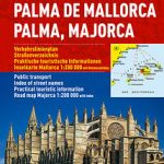
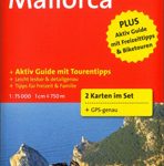
Mallorca 4-Map Set Kompass 2230

Mallorca on a set of four double-sided, contoured and GPS compatible maps at 1:35,000 from Kompass with exceptionally detailed presentation of the topography, extensive overprint for hiking trails and cycling routes, accommodation and places of interest, etc, plus street plans of central Palma de Mallorca, Platja de Palma, Sรณller, Alcรบdia/Port d’ Alcรบdia, Port de Pollenรงa, Artร and Felanitx.Landscape is presented by contours at 20m intervals enhanced by shading and graphic relief for rocky areas, plus colouring and/or graphics for woodlands, vineyards, etc. The overprint highlighting hiking paths indicates steep sections and routes partly requiring climbing experience, as well as the course of the GR221 long-distance trail. Cycle routes and mountain bike trails are also highlighted and symbols indicate campsites, youth hostels, mountain refuges, selected isolated hotels and inns, sport and recreational facilities, plus a wide range of other places of interest. Road network shows toll roads, entry restrictions, car parks and resting places, and stops of the island’s bus network. The map has a 1km UTM grid. Street plans indicate various facilities such as cash points, pharmacies, shopping centres, etc. Map legend includes English. PLEASE NOTE: Kompass also show Mallorca at 1:75,000 on a one-sheet, double-sided map but with less detailed presentation of the topography and recreational possibilities.


