Disclosure : This site contains affiliate links to products. We may receive a commission for purchases made through these links.
Mali Gizi Map
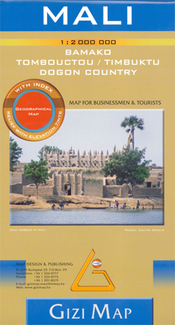
Mali at 1:2,000,000 from Gizi Map with excellent presentation of the country’s topography, an enlargement for the Dogon Plateau, street plans of Bamako and Timbuktu, all showing places of interest, plus an extensive index.Topography is shown by altitude colouring with spot heights and plenty of names of mountain ranges and other geographical features. Additional graphics show sandy or rocky deserts, swamps and flood plains, salt flats and seasonal wadis. Also marked and named are numerous water wells in the desert areas, and oasis. National parks and other protected areas are highlighted. Road network includes desert tracks, indicates border crossings and gives distances on main routes. The railway line to Bamako, local airports and ports along the Niger River are also shown, as well as the country’s administrative divisions with names of the provinces. The map highlights numerous places of interest and indicates locations with tourist accommodation. The map has latitude and longitude lines drawn at intervals of 1ยฐ and an extensive index. Map legend includes English.An enlargement at 1:1,500,000 shows the Dogon Plateau in greater detail. The Bamako area is presented at 1:50,000 naming main streets and neighbourhoods, with the city centre also shown at 1:12,000. A more general plan covers Timbuktu/Tombouctou at 1:10,000. All three plans highlight sights, hotels, medical facilities, etc.* This title is also available as a wall map.

Related Products:
 Mali Wall Map
 Mali ITMB
 Red Sea Gizi Map
 Ukraine – Moldova Gizi Map
 Mali & Mauritania ITMB
 Turkmenistan Gizi Map
 Oman – United Arab Emirates Gizi Map
 Turkmenistan Gizi Wall Map
 Syria Gizi Map
 Middle East Gizi Map
 Syria Gizi Wall Map
 Sudan – South Sudan Gizi Map
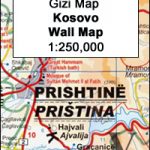 Kosovo Gizi Wall Map
 Tibet Gizi Map
 Tibet Gizi Road Map
 Morocco Gizi Map
 Vietnam – Laos – Cambodia Gizi Map
 Algeria Gizi Geographical Map
 Afghanistan – Kabul & 5 Cities Gizi Map
 Iran Gizi Map
Afghanistan – Kabul & 5 Cities Street Plans Gizi Wall Map
Iran Gizi Map
Afghanistan – Kabul & 5 Cities Street Plans Gizi Wall Map
 Macedonia Gizi Map
 Cuba Gizi Map
 Transylvania South-Eastern Gizi Map
 Libya Gizi Road Map
 Mali IGN 85008
 Montenegro & North Albania Gizi Map
 Somalia Gizi Map
 China Gizi Map Geographical Wall Map
 Montenegro & North Albania Gizi Wall Map
 Tunisia Nelles Map
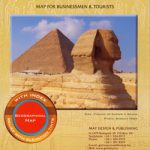 Egypt Gizi Map
 Ethiopia – Eritrea – Djibouti Gizi Map
 Costa Rica Borch
 New Zealand Gizi Map
 Cuba Nelles
 Saudi Arabia Gizi Map
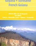 Venezuela, Guyana, Suriname & French Guiana Nelles Map
 Sikkim
 Mauritania Gizi Map