Disclosure : This site contains affiliate links to products. We may receive a commission for purchases made through these links.
Malaysia F&B
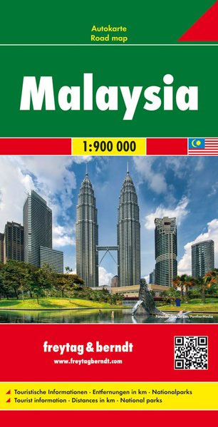
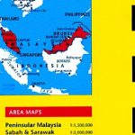
Malaysia on a double-sided, indexed map from Freytag & Berndt, covering both parts of the country at the same scale of 1:900,000; on one side Peninsular Malaysia, with Sarawak and Sabah on the reverse. Very effective relief shading with spot heights and graphics for swamps or mangrove areas and coral reefs provide good representation of the country’s topography.Road network includes selected local tracks; intermediate distances are given on main routes. Railways, local airports and ferry routes are shown, as well as the country’s internal administrative boundaries with names of the provinces. National parks and other protected areas are highlighted, and icons mark locations of various places of interest, including temples, beaches, caves, etc. The map has a latitude and longitude grid at intervals of 1ยบ and an index. Map legend includes English.

Related Products:
 Malaysia Reise Know-How
 Borneo – Malaysia East – Brunei – Kalimantan Nelles
 Malaysia – Brunei Nelles
 Malaysia Periplus Travel Map
 Malaysia ITMB
 Malaysia West – Singapore Nelles
 Peninsular Malaysia Periplus Travel Map
 Thailand F&B
 New Zealand Gizi Map
 Ukraine – Moldova F&B
 New Zealand Wall Map
 South Africa – Namibia – Botswana Hallwag Road Map
 Angola Reise Know-How
 Morocco Gizi Map
 Belarus F&B
 Japan Reise Know-How
 Morocco Wall Map
 Middle East F&B
 Philippines Reise Know-How
 Myanmar / Burma F&B
 Morocco IGN 85108
 Bosnia-Herzegovina – Montenegro Reise Know-How
 Philippines F&B
 Albania F&B Top 10 Tips
 Iran Gizi Map
 Montenegro F&B
 Norway South Reise Know-How
 Central America ITMB
 Taiwan Reise Know-How
 Iran Wall Map
 Belarus Jana Seta Road Map
 Zambia Reise Know-How
 Chile Reise Know-How
 South America ITMB Travel Atlas
 Europe Central F&B
 Pakistan Reise Know-How
 Jamaica Reise Know-How
 Lithuania Jana Seta Road Map
 Mexico Reise Know-How