Disclosure : This site contains affiliate links to products. We may receive a commission for purchases made through these links.
Categories
-
Best Sellers
-

SHOM Chart 7461 – De la Passe de Taapuna ร la Pointe Venus
PLEASE NOTE: the chart will be ordered for you if not currently in stock. Please allow 1-2 weeks for the chart to reach Stanfords. SHOM charts Read More » -

NOAA Chart 14992 – Sand Point Lake to Lac la Croix
***CHART WILL NOT BE UPDATED BY NOAA AFTER 12 JULY 2018, AFTER WHICH IT MAY NOT BE SAFE TO NAVIGATE WITH***NOAA maintains the nautical charts and Read More » -

Wilmslow, Macclesfield & Congleton Altrincham, Knutsford & Sandbach OS Explorer Active Map 268 (waterproof)
Wilmslow, Macclesfield, Congleton, Altrincham, Knutsford and Sandbach area on a detailed topographic and GPS compatible map No. 268, waterproof version, from the Ordnance Survey’s 1:25,000 Explorer Read More » -

Mauritius Marco Polo Pocket Guide
Marco Polo Pocket Guide Mauritius: the Travel Guide with Insider Tips. Explore Mauritius with this handy, pocket-sized, authoritative guide, packed with Insider Tips. Discover boutique hotels, Read More » -

The Metropolitan Museum of Modern Art 3D Expanding Guide – Pocket Pop up Book
The Metropolitan Museum of Modern Art 3D Expanding Guide – Pocket Pop up Book by Walker Books features twelve of The Metropolitan Museum’s most famous galleries Read More » -
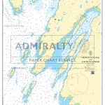
Admiralty Chart SC5611_12 – Crinan to Luing and Loch Craignish
NEWAdmiralty Small Craft nautical charts comply with Safety of Life at Sea (SOLAS) regulations and are ideal for professional, commercial and recreational use. Charts within the Read More » -

Once Upon an Alphabet
The letters of our alphabet work tirelessly to make words that in turn make stories, but what if there was a story for each of the Read More » -

Eye of the Beholder
By the early 17th century the Scientific Revolution was well under way. Philosophers and scientists were throwing off the yoke of ancient authority to peer at Read More » -

St Andrews & East Fife – Cupar, Anstruther & Crail OS Explorer Map 371 (paper)
St Andrews, East Fife, Cupar, Anstruther and Crail area on a detailed topographic and GPS compatible map No. 371, paper version, from the Ordnance Survey’s 1:25,000 Read More » -

Moscardon CNIG Topo 588-2
-


