Disclosure : This site contains affiliate links to products. We may receive a commission for purchases made through these links.
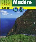
Madeira K+F Outdoor Map

Madeira at 1:40,000 on a contoured, GPS compatible outdoor map from Kรผmmerly + Frey printed on sturdy waterproof and tear-resistant synthetic paper. The map is double-sided on a more convenient size sheet and includes a street plan of central Funchal, plus coverage of the nearby Islas Desertas and Porto Santo at 1;70,000.The map divides Madeira east/west with a very generous overlap between the sides. Topography is shown by contours at 20m intervals, enhanced by relief shading and spot heights, plus colouring and/or graphics to indicate different types of terrain and vegetation. Waymarked hiking trails and footpaths are highlighted by overprint which indicates narrow steep sections. The map also shows cycle routes plus a selection of mountain bike and horse riding trails. A wide range of symbols mark various facilities and places of interest, including campsites, youth hostels, mountain huts, sport and recreational facilities, beaches, etc. The map has a 1-km UTM grid. Map legend includes English.The street plan of central Funchal shows main traffic arteries and highlights various places of interest.


