Disclosure : This site contains affiliate links to products. We may receive a commission for purchases made through these links.
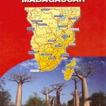
Madagascar IGN 85125
Madagascar at 1:1,250,000 from the IGN with cartography from MairDumont, with more smaller settlements than on other maps of the whole country. Very effective relief shading, altitude colouring and spot heights present the topography, with colouring and/or graphics for seasonal lakes and swamps, mangrove, sand dunes, rice fields, waterfalls, etc. National parks and other protected areas are highlighted.The map indicates unpaved roads and includes local tracks, showing routes closed to motorized traffic. No intermediate distances are marked. Railway lines and local airports or aerodromes are included. Symbols show various places of interest including campsites, beaches, diving and windsurfing sites, shipwrecks, etc. Latitude and longitude lines are drawn at 1ยฐ intervals. The map is not indexed. Map legend includes English.

Related Products:
 Germany K+F Road Map
 Germany South K+F Road Map
 Africa Central & South – Madagascar WATERPROOF
 Africa Central & South – Madagascar Michelin
 Djibouti IGN 85004
 Madagascar ITMB
 Madagascar F&B
 Angola
 Slovenia F&B
 Quito & Central Ecuador ITMB
 Slovenia F&B Top 10 Tips
 Brazil Michelin
 Pakistan ITMB
 Madagascar Reise Know-How
 Southern Balkans F&B Superatlas SPIRAL-BOUND
 Norway South Reise Know-How
 Belarus ITMB
 Azerbaijan Reise Know-How
 Switzerland 200K DOUBLE-SIDED
 Slovenia – Istria
 Cap of the North / Nordkalotten Norstedts Road Map
 Turkmenistan Gizi Map
 Cuba NGS Adventure Map 3112
 Galway County
 Croatia Reise Know-How
 Austria F&B Road Map Set
 South Jutland and Funen – Esbjerg – Odense
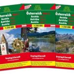 Austria F&B 3-Map Set
Turkmenistan Gizi Wall Map
Austria F&B 3-Map Set
Turkmenistan Gizi Wall Map
 Denmark South – Kolding – Copenhagen – Bornholm K+F Regional Road Map
 Namibia F&B
 Hungary – Budapest Road Atlas SPIRAL-BOUND
 Paris and its Environs IGN 88408
 Saudi Arabia F&B
 Baden-Wรผrttemberg Official Road Map
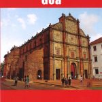 Goa
Goa
 Czech Republic ITMB
 Calabria F&B Top 10 Tips
 Vietnam ITMB
 Romania & Moldova ITMB