Disclosure : This site contains affiliate links to products. We may receive a commission for purchases made through these links.
Maasmechelen NGI Topo 26/7-8
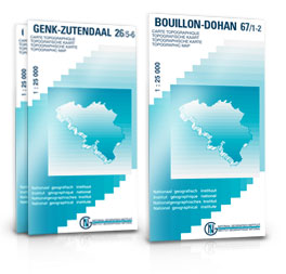
Topographical survey of Belgium at 1:20,000 from Nationaal Geografisch Instituut / Institut Gรฉographique National, the country’s national survey organization. Each 20K map covers one quarter of the corresponding 1:50,000 map (with adjustments in the border and coastal areas). The maps provide all the information expected of topographic mapping at this scale and additionally have an unusually large amount of vegetation and/or land use information (different types of woodlands, gardens, orchards, heath, etc). The maps have a 1-km UTM grid, with margin ticks for latitude and longitude at intervals of 1`. Map legend and a glossary of terms used on the maps include English.Stanfords keeps as regular stock 20K maps for the World War I battlefields around the Ypres, Messines and Passchendaele, and for the area of the Battle of Waterloo. The 1:20,000 survey covers the whole of Belgium and maps for other regions can be supplied as special orders. To see the list of titles in this series please click on the series link.PLEASE NOTE: the Long-Distance Footpaths Map of Belgium at 1:300,000 which shows the division of Belgium into the 50K survey sheets can also be used to see in more detail coverage by the 20K maps.

Related Products:
 Mol NGI Topo 17/1-2
 Ath NGI Topo 38/5-6
 Marche-en-Famenne NGI Topo 54/7-8
 Mettet NGI Topo 53/1-2
 Yvoir NGI Topo 53/3-4
 Dinant NGI Topo 53/7-8
Essen NGI Topo 01/7-8
Dinant NGI Topo 53/7-8
Essen NGI Topo 01/7-8
 Koksijde NGI Topo 11/7-8
 Lierneux NGI Topo 55/3-4
 Attert NGI Topo 68/3-4
 Aubange NGI Topo 71/3-4
 Kasterlee NGI Topo 16/3-4
 Alken NGI Topo 33/3-4
Hannut NGI Topo 41/1-2
Binche NGI Topo
Beauraing NGI Topo 58/3-4
Alken NGI Topo 33/3-4
Hannut NGI Topo 41/1-2
Binche NGI Topo
Beauraing NGI Topo 58/3-4
 Izegem NGI Topo 21/5-6
 Zandhoven NGI Topo 16/1-2
 Leignin NGI Topo 54/5-6
 Torhout NGI Topo 20/3-4
 Brasschaat NGI Topo 7/7-8
 Lommel NGI Topo 17/3-4
 Hasselt NGI Topo 25/7-8
 Watou NGI Topo 27/3-4
 Brecht NGI Topo 08/5-6
 Zomergem NGI Topo 13/7-8
 Antwerpen NGI Topo 15/3-4
 Autelbas NGI Topo 69/5-6
 Virton NGI Topo 71/1-2
Maarle NGI Topo 03/5-6
Genk NGI Topo 26/5-6
Namur NGI Topo 47/3-4
Virton NGI Topo 71/1-2
Maarle NGI Topo 03/5-6
Genk NGI Topo 26/5-6
Namur NGI Topo 47/3-4
 Beaumont NGI Topo 52/5-6
Enghien NGI Topo 38/3-4
Cerfontaine NGI Topo 57/3-4
Momignies NGI Topo 57/5-6
Bievre NGI Topo 64/1-2
Cul-des-Sarts NGI Topo 62/3-4
Neufchateau NGI Topo 65/5-6
Martelange NGI Topo 65/7-8
Beaumont NGI Topo 52/5-6
Enghien NGI Topo 38/3-4
Cerfontaine NGI Topo 57/3-4
Momignies NGI Topo 57/5-6
Bievre NGI Topo 64/1-2
Cul-des-Sarts NGI Topo 62/3-4
Neufchateau NGI Topo 65/5-6
Martelange NGI Topo 65/7-8