Disclosure : This site contains affiliate links to products. We may receive a commission for purchases made through these links.
Mรผrren – Oeschinensee – Sefinafurgga – Breithorn Swisstopo 1248
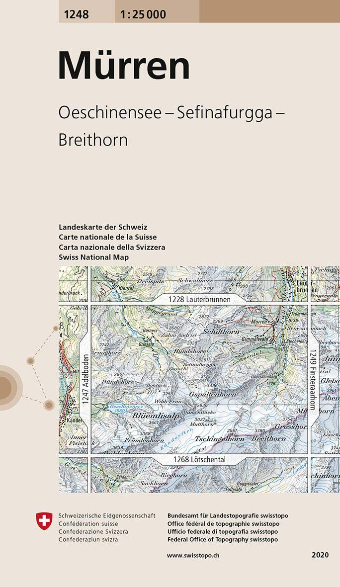
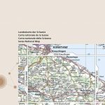
Map No. 1248, Mรผrren, in the topographic survey of Switzerland at 1:25,000 from Swisstopo. With Mรผrre, Gimmelwald and the upper part of the Lauterbrunnen Valley in the north-eastern part of the map, coverage extends southwards beyond the peak of Breithorn and west to Oeschinsee and Doldenhorn.Swiss topographic survey at 1:25,000 covers the whole country on 247 small format sheets, with special larger maps published for popular regions including some titles now available in hiking versions. Highly regarded for their superb use of graphic relief and hill shading, the maps give an almost 3-D picture of Switzerland`s mountainous terrain. Contours are at 10 m intervals, with 20m intervals in the mountainous areas. All the maps have a 1-km grid for Swiss national coordinates (datum CH 1903). SMALL FORMAT SHEETS (Nos. 1011 – 1374) – map legend in the language of the area covered by the map. Additional margin ticks show latitude and longitude in steps of 2`. The area covered by each map is 17 x 12 km (11 x 7 miles approx). SPECIAL LARGER SHEETS (Nos. from 2501 onwards) ‘“ STANDARD editions: no map legend is included but a separate leaflet can be provided instead. The area covered by each map is 25 x 17 km (15 x 11 miles approx).SPECIAL LARGER SHEETS (Nos. from 2501 onwards) ‘“ HIKING editions: an overprint highlights hiking, mountain and alpine paths, including regional and national long-distance trails. The maps also show bus routes with bus stops, plus inns in remote locations. The area covered by each map is 25 x 17 km (15 x 11 miles approx).

Related Products:
 Gex Swisstopo 1280
Piz Lad Swisstopo 1199bis
Gex Swisstopo 1280
Piz Lad Swisstopo 1199bis
 Wil Swisstopo 1073
Zug Swisstopo 1131
Wil Swisstopo 1073
Zug Swisstopo 1131
 Val de Ruz Swisstopo 1144
Elm Swisstopo 1174
Val de Ruz Swisstopo 1144
Elm Swisstopo 1174
 Bischofszell Swisstopo 1074
 Schรถftland Swisstopo 1109
Stรคfa Swisstopo 1112
Klรถntal Swisstopo 1153
Vรคttis Swisstopo 1175
Schรถftland Swisstopo 1109
Stรคfa Swisstopo 1112
Klรถntal Swisstopo 1153
Vรคttis Swisstopo 1175
 Lรถtschental Swisstopo 1268
 Basรฒdino Swisstopo 1271
 Val-d`Illiez Swisstopo 1304
 Singen Swisstopo 1012
 Kreuzlingen Swisstopo 1034
 Rheinfelden Swisstopo 1048
 Weinfelden Swisstopo 1054
 Sissach Swisstopo 1068
St. Margrethen Swisstopo 1076
Sissach Swisstopo 1068
St. Margrethen Swisstopo 1076
 Hauenstein Swisstopo 1088
 Gais Swisstopo 1095
Diepoldsau Swisstopo 1096
Gais Swisstopo 1095
Diepoldsau Swisstopo 1096
 Balsthal Swisstopo 1107
Linthebene Swisstopo 1133
Buchs Swisstopo 1135
Balsthal Swisstopo 1107
Linthebene Swisstopo 1133
Buchs Swisstopo 1135
 Burgdorf Swisstopo 1147
Travers Swisstopo 1163
Burgdorf Swisstopo 1147
Travers Swisstopo 1163
 Grandson Swisstopo 1183
Arosa Swisstopo 1196
Grandson Swisstopo 1183
Arosa Swisstopo 1196
 Innertkirchen Swisstopo 1210
 Guttannen Swisstopo 1230
 Albulapass Swisstopo 1237
 Montreux Swisstopo 1264
 Campodolcino Swisstopo 1275
 Piz Bernina Swisstopo 1277
 Sierre Swisstopo 1287
 Rosablanche Swisstopo 1326
Tesserete Swisstopo 1333
Rosablanche Swisstopo 1326
Tesserete Swisstopo 1333
 Col de Balme Swisstopo 1344