Disclosure : This site contains affiliate links to products. We may receive a commission for purchases made through these links.
Luxembourg 2-Map Set Kompass 2202
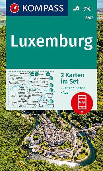
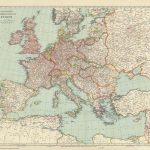
Luxembourg and the adjoining areas of the Ardennes in Belgium and the Eifel in Germany at 1:50,000 on a set of two double-sided walking maps from Kompass, Europe’s largest publishers of recreational maps which provide extensive coverage of central Europe, the Alps and other popular hiking regions.Topography is shown by contours at 10m intervals, enhanced by relief shading plus colouring and/or graphics to show different types of vegetation and terrain. An overprint highlights waymarked hiking trails, cycle and mountain bike routes, plus selected cross-country ski routes, and shows, where appropriate, their official name and/or number. A very wide range of symbols indicate locations of various tourist facilities and places of interest, including different types of accommodation (campsites, youth hostels, refuges, country inns and hotels), sport facilities and/or sites (riding stables, climbing sites, etc), cultural and historical sites, interesting natural sites including outstanding trees, etc. Each map has a 2-km UTm grid for GPS users. Map legend includes English.Coverage extends beyond Luxembourg’s borders to include part of the Belgian Ardennes with Arlon, Bastogne, Houffalize and Stankt Vith, plus in the east much of the Eifel in Germany with Prรผm, Gerolstein, Bittburg and Trier, as well as part of the Saar-Hunsrรผck Regional Park.

Related Products:
 Northern Luxembourg – Southern Eifel: Diekirch – Waxweiler
 Southern Luxembourg – The Moselle Valley: Luxembourg City – Trier
 Luxembourg – Gaume – Ardennes Alta Via Hiking Map
 High Eifel – Central Eifel Kompass 838
 Luxembourg Bradt Guide
 The Ultimate Netherlands, Belgium & Luxembourg Cycle Route Planner
 Eifel 4-Map Set Kompass 833
 Aachen – Duren – NP Eifel – Rureifel – Hohes Venn Kompass 757
 The Ardennes Walking Guide – Belgium, Luxembourg and the Ardennes
 Schneifel – Ahreifel – Schleiden – Prum – Daun – Eifelsteig Kompass 836
 Luxembourg North
 Luxembourg South
 Wรผrzburg – Maindreieck – Schweinfurt – Franconian Wine Country Kompass 166
 Burgenland 2-Map Set Kompass 227
 Vorarlberg 2-Map Set Kompass 292
 Harz 2-Map Set Kompass 450
Spessart 2-Map Set Kompass 832
Stuttgart and Environs 2-Map Set Kompass 780
Harz 2-Map Set Kompass 450
Spessart 2-Map Set Kompass 832
Stuttgart and Environs 2-Map Set Kompass 780
 Wienerwald 2-Map Set Kompass 208
Fรผssen – Ausserfern Kompass 4
Wienerwald 2-Map Set Kompass 208
Fรผssen – Ausserfern Kompass 4
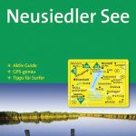 Neusiedler See Kompass 215
 Luxembourg Michelin
 Saarland 2-Map Set Kompass 825
Starnberger See Kompass 793
Saarland 2-Map Set Kompass 825
Starnberger See Kompass 793
 Rรผgen Kompass 737
 Bonn – Ahrtal Kompass 820
 Flensburg – Kappeln Kompass 707
 Innsbruck and Environs 2-Map Set Kompass 290
Munich and Environs 2-Map Set Kompass 184
Bavarian Forest 3-Map Set Kompass 198
Nuremberg and Environs 2-Map Set Kompass 163
Vienna and Environs 2-Map Set Kompass 205
Innsbruck and Environs 2-Map Set Kompass 290
Munich and Environs 2-Map Set Kompass 184
Bavarian Forest 3-Map Set Kompass 198
Nuremberg and Environs 2-Map Set Kompass 163
Vienna and Environs 2-Map Set Kompass 205
 Frankenhรถhe Kompass 164
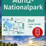 Mรผritz NP Kompass 853
Tannheimer Tal Kompass 04
Mรผritz NP Kompass 853
Tannheimer Tal Kompass 04
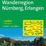 Nuremberg – Erlangen Kompass 170
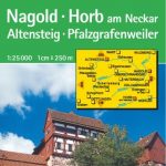 Nagold – Horb Kompass 874
 Schweriner Seengebiet Kompass 850
 Luxembourg City and the Surrounding Area
 Millstรคtter See Kompass 066