Disclosure : This site contains affiliate links to products. We may receive a commission for purchases made through these links.
Luton
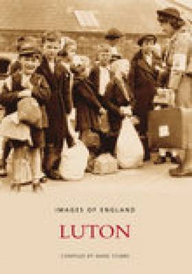
A history of Luton

Related Products:
 Luton 1879 – 33.05a Coloured Edition
 Luton 1922 – 33.05
 Luton, Hertford, Hitchin & St Albans OS Landranger Map 166 (paper)
 Luton, Hertford, Hitchin & St Albans OS Landranger Active Map 166 (waterproof)
 Luton & Stevenage – Hitchin & Ampthill OS Explorer Map 193 (paper)
 Luton & Stevenage – Hitchin & Ampthill OS Explorer Active Map 193 (waterproof)
 The History Book
 Bristol – Hometown History – Activity Book
 A History of Wales
 A Brief History of Everyone Who Ever Lived: The Stories in Our Genes
 A Less Boring History of the World
 The Little Book of Big History: The Story of Life, the Universe and Everything
 Dogs, A Very Peculiar History
 London – The Biography
 Bloody History Oxford
 The Disastrous History of London
 The History Of England`s Cathedrals
 Muswell History & Guide
 The Secret History of Our Streets: London
 Sweden – Concise History
 Bolivia – Concise History
 Austria – Concise History
 Finland – Concise History
 Bulgaria – Concise History
 New Zealand – Concise History
 History Year by Year
 The Quest for a Moral Compass: A Global History of Ethics
 Timelines of Everything
 Modern India – Concise History
 South Africa – Concise History
 History of the Arab Peoples
 South East England A-Z Road Atlas
 The Basque History of the World
 Central Bristol History Tour
 A Short History of Byzantium
 Prisoners of History: What Monuments to the Second World War Tell Us About Our History and Ourselves
 Louisiana: A History
 The Art Of Camping – The History And Practice Of Sleeping Under The Stars
 Scotland: A History from Earliest Times
 London A Very Peculiar History