Disclosure : This site contains affiliate links to products. We may receive a commission for purchases made through these links.
Luneburg Heath Kompass 718
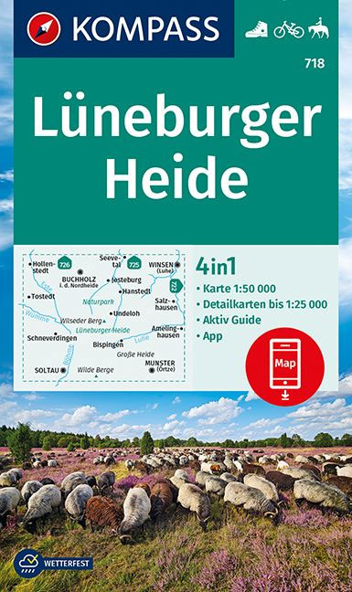
Lรผneburger Heide area of northern Germany on a detailed, GPS compatible map at 1:50,000 from Kompass with local and long-distance footpaths, cycling routes, accommodation, etc, printed on durable, waterproof and tear-resistant synthetic paper.KOMPASS HIKING & RECREATIONAL MAPS: this title is part of an extensive series covering Austria, much of Germany and the Slovenian Alps ‘“ TO SEE OTHER TITLES IN THIS SERIES PLEASE CLICK ON THE SERIES LINK. Kompass are Europe’s largest publishers of hiking maps; their mapping of other countries, including expanding coverage of Italy, is listed on our website separately.CARTOGRAPHY: the maps are contoured with additional shading, graphic relief and colouring to provide a more detailed picture of the terrain, vegetation and/or land use. Contour interval varies from 10m in the coastal areas of Northern Germany to 40 or 50 metres in the mountainous regions. All the maps highlight local and long-distance waymarked footpaths, including climbing trails. Most titles also show cycling routes, mountain bike trails, and, the in mountainous areas, ski routes. The maps indicate various types of accommodation (selected inns and hotels, youth hostels, campsites, mountain refuges), as well as recreational facilities, places of interest, etc. Latest editions also show access by public transport with bus stops and/or Park+Ride facilities.GEOGRAPHICAL COORDINATES: unless indicated to the contrary in the individual description, the maps have a UTM grid for GPS users. MAP LEGEND: most maps now include full English legend, particularly titles covering the Alpine areas. Some maps covering mainly eastern Austria or the less popular parts of Germany may still have a legend in German only.OTHER FEATURES: selected titles include on the reverse panorama drawings of their area with names of villages, peaks, valleys, etc. and/or have a booklet with pictures of local wild flowers with their Latin names. Many titles are now published as competitively priced sets of two or more maps, offering a wider coverage.BOOKLETS: PLEASE NOTE BEFORE ORDERING – many titles come with a booklet describing the area and/or various hiking routes. Unless indicated in the individual description that the booklet includes English, these booklets are IN GERMAN only. The booklets are not necessary to use the maps since, as stated above, full English language map legend is provided.

Related Products:
 Spessart 2-Map Set Kompass 832
Stuttgart and Environs 2-Map Set Kompass 780
Spessart 2-Map Set Kompass 832
Stuttgart and Environs 2-Map Set Kompass 780
 Burgenland 2-Map Set Kompass 227
Vorarlberg 2-Map Set Kompass 292
Burgenland 2-Map Set Kompass 227
Vorarlberg 2-Map Set Kompass 292
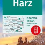 Harz 2-Map Set Kompass 450
 Saarland 2-Map Set Kompass 825
Starnberger See Kompass 793
Saarland 2-Map Set Kompass 825
Starnberger See Kompass 793
 Rรผgen Kompass 737
 Wienerwald 2-Map Set Kompass 208
 Frankenhรถhe Kompass 164
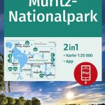 Mรผritz NP Kompass 853
Mountain Route Odenwald-Neckar Valley 2-Map Set Kompass 827
The Ruhr 3-Map Set Kompass 821
Mรผritz NP Kompass 853
Mountain Route Odenwald-Neckar Valley 2-Map Set Kompass 827
The Ruhr 3-Map Set Kompass 821
 East Frisia – Oldenburg 3-Map Set Kompass 410
Tannheimer Tal Kompass 04
East Frisia – Oldenburg 3-Map Set Kompass 410
Tannheimer Tal Kompass 04
 Innsbruck and Environs 2-Map Set Kompass 290
Munich and Environs 2-Map Set Kompass 184
Bavarian Forest 3-Map Set Kompass 198
Nuremberg and Environs 2-Map Set Kompass 163
Vienna and Environs 2-Map Set Kompass 205
Innsbruck and Environs 2-Map Set Kompass 290
Munich and Environs 2-Map Set Kompass 184
Bavarian Forest 3-Map Set Kompass 198
Nuremberg and Environs 2-Map Set Kompass 163
Vienna and Environs 2-Map Set Kompass 205
 Mรผritz and Environs 2-Map Set Kompass 855
Fรผssen – Ausserfern Kompass 4
Mรผritz and Environs 2-Map Set Kompass 855
Fรผssen – Ausserfern Kompass 4
 Liechtenstein – Feldkirch – Vaduz Kompass 21
 Hohe Tauern NP 3-Map Set Kompass 50
Berlin and Environs 4-Map Set Kompass 700
Hohe Tauern NP 3-Map Set Kompass 50
Berlin and Environs 4-Map Set Kompass 700
 Millstรคtter See Kompass 066
 Altรถtting – Burghausen Kompass 199
 Flensburg – Kappeln Kompass 707
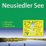 Neusiedler See Kompass 215
 Franconian Lake District Kompass 174
Elbsandsteingebirge – Sรคchsische Schweiz NP Kompass 761
Franconian Lake District Kompass 174
Elbsandsteingebirge – Sรคchsische Schweiz NP Kompass 761
 Salzkammergut 2-Map Set Kompass 229
Hamburg and Environs 2-Map Set Kompass 725
Lower Bavaria 3-Map Set Kompass 160
Salzkammergut 2-Map Set Kompass 229
Hamburg and Environs 2-Map Set Kompass 725
Lower Bavaria 3-Map Set Kompass 160
 Frankfurt & Environs 50K Kompass 2-Map Set No. 828
Salzburg and Environs 2-Map Set Kompass 291
Frankfurt & Environs 50K Kompass 2-Map Set No. 828
Salzburg and Environs 2-Map Set Kompass 291
 Mayrhofen – Tuxer Tal – Zillergrund Kompass 037
 Zell am See – Kaprun Kompass 030
Innsbruck – Brenner Kompass 36
Zell am See – Kaprun Kompass 030
Innsbruck – Brenner Kompass 36
 Seefeld in Tirol – Leutasch Kompass 026