Disclosure : This site contains affiliate links to products. We may receive a commission for purchases made through these links.
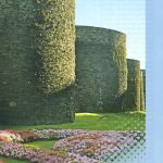
Lugo and Environs CNIG Map

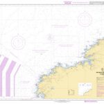
Lugo and its environs on a double-sided map combining a street plan with topographic mapping at 1:50,000 from the Instituto Geogrรกfico Nacional ‘“ Centro Nacional de Informaciรณn Geograficรก, the country’s civilian survey organization.On one side is a street plan of the city showing the course along its streets of the Camino de Santiago ‘“ the Way of St. James. The plan is not indexed and does not include information such as one way streets or car parks. A big, clear enlargement presents the city’s historic hear in greater detail with a list of eight places interest highlighted on it.On the reverse is an extract from the Spanish civilian topographic survey at 1:50,000, centred on Lugo. The map has contours at 20m intervals, enhanced by relief shading, plus colouring and/or graphics to show different types of terrain, vegetation or land use. In addition to all the usual information shown on topographic maps at this scale: detailed presentation of the road and rail networks, rural tracks and paths, etc, the map also shows campsites and mountain refuges. The map has a 1-km UTM grid, with margin ticks for latitude and longitude at 1` intervals. Map legend is in Spanish only.

Related Products:
 Burgos and Environs CNIG Map
 Lugo CNIG Topo 72
 Toledo and Environs CNIG Map
 Oviedo and Environs CNIG Map
 Lugo Province 200K CNIG Map No. 29
 Sencelles 25K Mallorca CNIG Topographic Survey Map No. 699-I
Sineu 25K Mallorca CNIG Topographic Survey Map No. 699-II
Algaida 25K Mallorca CNIG Topographic Survey Map No. 699-III
Porreres 25K Mallorca CNIG Topographic Survey Map No. 699-IV
Santandria 25K Menorca CNIG Topographic Survey Map No. 646-I
Alaior 25K Menorca CNIG Topographic Survey Map No. 646-II
Es Grau 25K Menorca CNIG Topographic Survey Map No. 647-I
Lugo CNIG Topo 72-4
S`Espalmador 25K Formentera CNIG Topographic Survey Map No. 824-II/825-I
Cala en Porter 25K Menorca CNIG Topographic Survey Map No. 646-IV
Galatzo 25K Mallorca CNIG Topographic Survey Map No. 697-II
Can Picafort 25K Mallorca CNIG Topographic Survey Map No. 672-I
Pilar de la Mola 25K Formentera CNIG Topographic Survey Map No. 825-III/850-I
Sencelles 25K Mallorca CNIG Topographic Survey Map No. 699-I
Sineu 25K Mallorca CNIG Topographic Survey Map No. 699-II
Algaida 25K Mallorca CNIG Topographic Survey Map No. 699-III
Porreres 25K Mallorca CNIG Topographic Survey Map No. 699-IV
Santandria 25K Menorca CNIG Topographic Survey Map No. 646-I
Alaior 25K Menorca CNIG Topographic Survey Map No. 646-II
Es Grau 25K Menorca CNIG Topographic Survey Map No. 647-I
Lugo CNIG Topo 72-4
S`Espalmador 25K Formentera CNIG Topographic Survey Map No. 824-II/825-I
Cala en Porter 25K Menorca CNIG Topographic Survey Map No. 646-IV
Galatzo 25K Mallorca CNIG Topographic Survey Map No. 697-II
Can Picafort 25K Mallorca CNIG Topographic Survey Map No. 672-I
Pilar de la Mola 25K Formentera CNIG Topographic Survey Map No. 825-III/850-I
 Haria 25K Lanzarote CNIG Topographic Survey Map No. 1080-IV
Cap Blanc 25K Mallorca CNIG Topographic Survey Map No. 723-IV
Illa des Conills 25K CNIG Topographic Survey Map No. 748-III
Illa de Cabrera 25K CNIG Topographic Survey Map No. 774-I
Es Cubells 25K Ibiza CNIG Topographic Survey Map No. 798-III
Arta 25K Mallorca CNIG Topographic Survey Map No. 672-IV
Sabinosa 25K Hierro CNIG Topographic Survey Map No. 1105-III
Tetir 25K Fuerteventura CNIG Topographic Survey Map No. 1090-II
Tinajo 25K Lanzarote CNIG Topographic Survey Map No. 1082-I
Vallehermoso 25K La Gomera CNIG Topographic Survey Map No. 1095-III
Los Verodes 25K Fuerteventura CNIG Topographic Survey Map No. 1099-II
La Lajita 25K Fuerteventura CNIG Topographic Survey Map No. 1100-I
Candelaria 25K Tenerife CNIG Topographic Survey Map No. 1092-II
Esporles CNIG Topographic Map 670-9
Telde 25K Spain CNIG Topographic Survey Map No. 1104-IV
El Roque 25K Fuerteventura CNIG Topographic Survey Map No. 1086-I
El Castillo 25K Fuerteventura CNIG Topographic Survey Map No. 1094-I
Soo 25K Lanzarote CNIG Topographic Survey Map No. 1080-III
Port de Benirras 25K Ibiza CNIG Topographic Survey Map No. 772-II
El Tablero 25K Gran Canaria CNIG Topographic Survey Map No. 1107-III
Isla de Alegranza 25K CNIG Topographic Survey Map No. 1079-II
Pajara 25K Fuerteventura CNIG Topographic Survey Map No. 1093-III/IV
Haria 25K Lanzarote CNIG Topographic Survey Map No. 1080-IV
Cap Blanc 25K Mallorca CNIG Topographic Survey Map No. 723-IV
Illa des Conills 25K CNIG Topographic Survey Map No. 748-III
Illa de Cabrera 25K CNIG Topographic Survey Map No. 774-I
Es Cubells 25K Ibiza CNIG Topographic Survey Map No. 798-III
Arta 25K Mallorca CNIG Topographic Survey Map No. 672-IV
Sabinosa 25K Hierro CNIG Topographic Survey Map No. 1105-III
Tetir 25K Fuerteventura CNIG Topographic Survey Map No. 1090-II
Tinajo 25K Lanzarote CNIG Topographic Survey Map No. 1082-I
Vallehermoso 25K La Gomera CNIG Topographic Survey Map No. 1095-III
Los Verodes 25K Fuerteventura CNIG Topographic Survey Map No. 1099-II
La Lajita 25K Fuerteventura CNIG Topographic Survey Map No. 1100-I
Candelaria 25K Tenerife CNIG Topographic Survey Map No. 1092-II
Esporles CNIG Topographic Map 670-9
Telde 25K Spain CNIG Topographic Survey Map No. 1104-IV
El Roque 25K Fuerteventura CNIG Topographic Survey Map No. 1086-I
El Castillo 25K Fuerteventura CNIG Topographic Survey Map No. 1094-I
Soo 25K Lanzarote CNIG Topographic Survey Map No. 1080-III
Port de Benirras 25K Ibiza CNIG Topographic Survey Map No. 772-II
El Tablero 25K Gran Canaria CNIG Topographic Survey Map No. 1107-III
Isla de Alegranza 25K CNIG Topographic Survey Map No. 1079-II
Pajara 25K Fuerteventura CNIG Topographic Survey Map No. 1093-III/IV