Disclosure : This site contains affiliate links to products. We may receive a commission for purchases made through these links.
Lugnaquilla & Glendalough

Lugnaquilla and Glendalough area of the Wicklow Mountains at 1:30,000 on a detailed GPS compatible map from EastWest Mapping, printed on waterproof and tear-resistant paper. Contours at 10m intervals are enhanced by altitude colouring and graphics showing scree, peat bogs, marshland, gorse, different types of woodlands, cultivated areas, etc.The map shows the boundary of the Wicklow Mountains National Park and highlights the Wicklow Way, St. Kevin`s Way and other agreed access routes. Hillwalking access points are marked and a note provides information on the rules of public access to the land. A wide range of symbols indicate various places of interest including hotels and campsites, pubs, shops, restaurants, rock climbing and bird watching sites, recreational facilities, historical and geological sites, etc. The map has a 1km UTM grid and provides a list of useful websites for additional information.To see the other titles in this series please click on the series link.

Related Products:
 Dublin and North Wicklow Mountains (30K)
 Wicklow Mountains East
 Ireland: EastWest Mapping Hiking Maps of the Wicklow Mountains
 Dublin Mountains (25K)
 Wicklow Mountains Harvey Superwalker XT30
 Gurghiu Mountains Northern and Central Dimap Hiking Map
 Kaunas and Environs
Anyksciai Regional Park Tourist Map
Kaunas and Environs
Anyksciai Regional Park Tourist Map
 Swartberg and Klein-Karoo
Dzukija National Park
ลฝemaitija National Park
Aukลกtaitijos National Park
Swartberg and Klein-Karoo
Dzukija National Park
ลฝemaitija National Park
Aukลกtaitijos National Park
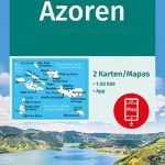 Azores 2-Map Set Kompass 2260
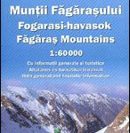 Fagaras Mountains Dimap Hiking Map
Grazute – Sartai Regional Parks Tourist Map
Curonian Spit National Park
Panemuniu – Dubysa – Rambynas Regional Parks
Fagaras Mountains Dimap Hiking Map
Grazute – Sartai Regional Parks Tourist Map
Curonian Spit National Park
Panemuniu – Dubysa – Rambynas Regional Parks
 Gotland Norstedts Road Map
 Elba Global Map Tourist Map
 Fes (Fez) and Meknes
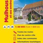 Mulhouse and its Environs IGN Map
Lithuania: Alma Littera 100K Regional Maps
Gilau Mountains Dimap Hiking Map
Mulhouse and its Environs IGN Map
Lithuania: Alma Littera 100K Regional Maps
Gilau Mountains Dimap Hiking Map
 Krkonoลกe – Giant Mountains Kompass 2087
 Strasbourg and its Environs IGN 88412
 Northern Tajikistan
Tarcau Mountains and Ghimes Dimap Hiking Map
Northern Tajikistan
Tarcau Mountains and Ghimes Dimap Hiking Map
 Western Tatras – Polish and Slovak
 Cederberg Touring Map
 Bergen Cappelen Street Plan
 Cuba Gizi Map
 Europe Cycle Route R1 – Arnhem via Berlin to Oder Bikeline Map-Guide
 Podhale – Tatras – Orawa – Spisz
 Cuba Wall Map
 Mulde Valley Cycle Route – Erzgebirge to Dessau Bikeline Map-Guide
 Weser – Harz – Heide Cycle Route: Hann. Mรผnden – Lรผneburg (416km) Bikeline Map/Guide
 Surrey, East & West Sussex A-Z Visitors` Map
 Cape Town Borch
 Rodnei Mountains Dimap Hiking Map
 Czech Republic Road Atlas