Disclosure : This site contains affiliate links to products. We may receive a commission for purchases made through these links.
Ludlow, Tembury and Dirtrict 1897
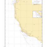
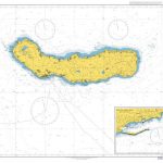
Ludlow, Tembury and District 1897 in a series of reproductions of Ordnance Survey’s famous “Inch to the Mile” maps published in the Alan Godfrey Editions to provide a historical record of England and Wales in the second half of 19th and early 20th century.In this title coverage stretches from Leintwardine eastward to Tenbury Wells, and from Bromfield southward to the outskirts of Leominster. Other locations include: in HEREFORDSHIRE Adforton, Aston, Aymestrey, Burrington, Collington, Downton on the Rock, Elton, Eye, Eyton, Hatfield, Kimbolton, Kingsland, Leinthall Starkes, Little Hereford, Lucton, Middleton on the Hill, Orleton, Pudleston, Richards Castle, Rochford, Shobdon, Thornbury, Wigmore and Yarpole; in SHROPSHIRE Ashford Bowdler, Ashford Carbonell, Bitterley, Boraston, Burford, Caynham, Corley, Greet, Hope Baggot, Hopton Waters, Milson, Neen Sollars and Whitton; plus in WORCESTERSHIRE Hanley Child and Stoke Bliss. On the reverse is a detailed map of Woofferton Junction including part of Brimfield.About the Alan Godfrey Editions of the OS Inch to the Mile Maps: the maps provide an invaluable overview of a wider area, typically 18 x 12 miles (29 x 19 kms approx.), and offer historical mapping for small towns and villages not covered by the more detailed series for which the Godfrey Editions are better known. On the reverse all the maps have historical notes and most titles also include a more detailed, large scale map of a small town or a village in the area.To see other titles in this series please click on the series link.

Related Products:
 The Mendips 1897 – 280
Weston-super-Mare & Highbridge 1897 – 279
Isle of Thanet 1893 – 274
Redesdale 1866
South Huntingdonshire 1897
The Mendips 1897 – 280
Weston-super-Mare & Highbridge 1897 – 279
Isle of Thanet 1893 – 274
Redesdale 1866
South Huntingdonshire 1897
 Great Britain: Godfrey Editions of Historical Ordnance Survey Inch to a Mile Maps of England & Wales
Kielder 1866
Montgomery and District 1908
Beachy Head, Newhaven and Eastbourne 1880 – 1903
The Cheviot 1901-13 – 5
Isles of Scilly 1896
Penzance and St Ives Bay 1888
Marlborough, Avebury & the Downs 1897 – 266 Coloured Edition
Ravenglass and Sellafield 1875
Dartmoor 1908
The Medway Towns 1893
Great Britain: Godfrey Editions of Historical Ordnance Survey Inch to a Mile Maps of England & Wales
Kielder 1866
Montgomery and District 1908
Beachy Head, Newhaven and Eastbourne 1880 – 1903
The Cheviot 1901-13 – 5
Isles of Scilly 1896
Penzance and St Ives Bay 1888
Marlborough, Avebury & the Downs 1897 – 266 Coloured Edition
Ravenglass and Sellafield 1875
Dartmoor 1908
The Medway Towns 1893
 Hamilton Low Parks 1897
Ashford (Middx) 1935 – 24.04
Foulness and Mersea 1904
Middle Tamar and Caradon 1894
Norham & Berwick 1864 – 1
South Chilterns 1886
Formby, Crosby and District 1896
Tunbridge Wells and Ashdown Forest 1894
North Kent Coast 1878
Hertford and St Albans 1898
Selsey Bill, Bognor and Worthing 1901
North Chilterns 1888
Bristol and District 1912
Longtown, Bewcastle and District 1902
The Solent 1888
North West Gloucestershire 1896
Holy Island & District 1863 – 4
Horsham, Crawley and St Leonards`s Forest 1901
East Surrey and Mole Valley 1885
East Radnorshire 1908
North Dartmoor and Mid-Devon 1887
Ashford (North) 1934 – 19.16
Rothbury Forest 1866-1873
Exeter and the Lower Exe Valley 1888
Hamilton Low Parks 1897
Ashford (Middx) 1935 – 24.04
Foulness and Mersea 1904
Middle Tamar and Caradon 1894
Norham & Berwick 1864 – 1
South Chilterns 1886
Formby, Crosby and District 1896
Tunbridge Wells and Ashdown Forest 1894
North Kent Coast 1878
Hertford and St Albans 1898
Selsey Bill, Bognor and Worthing 1901
North Chilterns 1888
Bristol and District 1912
Longtown, Bewcastle and District 1902
The Solent 1888
North West Gloucestershire 1896
Holy Island & District 1863 – 4
Horsham, Crawley and St Leonards`s Forest 1901
East Surrey and Mole Valley 1885
East Radnorshire 1908
North Dartmoor and Mid-Devon 1887
Ashford (North) 1934 – 19.16
Rothbury Forest 1866-1873
Exeter and the Lower Exe Valley 1888