Disclosure : This site contains affiliate links to products. We may receive a commission for purchases made through these links.
Lower Irlam and Cadishead 1926

Lower Irlam and Cadishead in 1926 in a fascinating series of reproductions of old Ordnance Survey plans in the Alan Godfrey Editions, ideal for anyone interested in the history of their neighbourhood or family. The map covers Lower Irlam, with coverage running along the Liverpool Road towards Cadishead; Green Lane and Lords Street are at the foot of the map. The major feature on the map is the massive Partington Steel & Iron Works with its many sidings, and the map also has a stretch of the Manchester Ship Canal with sidings leading to wharves or bunkering facilities. Other features include stretches of the Cheshire Lines Railway with Irlam and Cadishead stations, Glazebrook Exchange Sidings, Glazebrook Hall, St Mary`s church, Wallpaper works, engineering works, Higher Stanley Bank Farm, other farms along Moss Road, etc. On the reverse are 1918 directories for Irlam, Cadishead and Chat Moss.About the Alan Godfrey Editions of the 25″ OS Series:Selected towns in Great Britain and Ireland are covered by maps showing the extent of urban development in the last decades of the 19th and early 20th century. The plans have been taken from the Ordnance Survey mapping and reprinted at about 15 inches to one mile (1:4,340). On the reverse most maps have historical notes and many also include extracts from contemporary directories. Most maps cover about one mile (1.6kms) north/south, one and a half miles (2.4kms) across; adjoining sheets can be combined to provide wider coverage.FOR MORE INFORMATION AND A COMPLETE LIST OF ALL AVAILABLE TITLES PLEASE CLICK ON THE SERIES LINK.

Related Products:
 Irlam Hall 1926
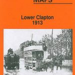 Lower Clapton 1913 – 31.3
 Hunmanby 1926
 Malvern Link 1926
Malvern: The Wyche 1926
Flixton 1904
Urmston 1926
Malvern Link 1926
Malvern: The Wyche 1926
Flixton 1904
Urmston 1926
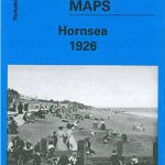 Hornsea 1926
Great Malvern East 1926
Bromsgrove 1926
Bewdley 1926
East Jarrow 1913
Exeter and the Lower Exe Valley 1888
Moss Valley and Gwersyllt 1909
Wolverhampton Bushbury 1914
Hornsea 1926
Great Malvern East 1926
Bromsgrove 1926
Bewdley 1926
East Jarrow 1913
Exeter and the Lower Exe Valley 1888
Moss Valley and Gwersyllt 1909
Wolverhampton Bushbury 1914
 Ilford 1938
Milngavie 1896
Ilford 1938
Milngavie 1896
 Altrincham 1908
 Putney & NW Wandsworth 1894 – 113.2
Rose Grove and Habergham 1909
Aberaeron 1904
Stranton & Southern Hartlepool 1896 – 37.15
Sheffield Park 1903
Luton 1922 – 33.05
Openshaw 1905
Putney & NW Wandsworth 1894 – 113.2
Rose Grove and Habergham 1909
Aberaeron 1904
Stranton & Southern Hartlepool 1896 – 37.15
Sheffield Park 1903
Luton 1922 – 33.05
Openshaw 1905
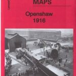 Openshaw 1916
Trafford Park South 1937
Great Malvern and West Malvern 1926
North Chorley 1909 – 77.08
Port Sunlight and Bebington 1897
Lye 1914
Patricroft and Monton 1905
Mossend 1939 – 12.05
Jarrow 1912
Crook West 1895
Pelton Fell 1915
Selly Oak and Bournville 1903
Attercliffe 1903 – 295.01a
Wincobank & Meadowhall 1902 – 289.13a
Oswaldtwistle and Church 1909
Openshaw 1916
Trafford Park South 1937
Great Malvern and West Malvern 1926
North Chorley 1909 – 77.08
Port Sunlight and Bebington 1897
Lye 1914
Patricroft and Monton 1905
Mossend 1939 – 12.05
Jarrow 1912
Crook West 1895
Pelton Fell 1915
Selly Oak and Bournville 1903
Attercliffe 1903 – 295.01a
Wincobank & Meadowhall 1902 – 289.13a
Oswaldtwistle and Church 1909