Disclosure : This site contains affiliate links to products. We may receive a commission for purchases made through these links.
Lower Clapton 1913 – 31.3

Lower Clapton in 1913 in a fascinating series of reproductions of old Ordnance Survey plans in the Alan Godfrey Editions, ideal for anyone interested in the history of their neighbourhood or family. Three versions each cover the same area, stretching from Clarence Road and Lower Clapton Road eastward to Hackney Marsh and Leyton Marshes, with the northern part of Templemills Siding; and from Clifden Road northward to Mountpleasant Lane. The Hackney Cut Navigation runs through the map, with the River Lea winding nearby. Each map includes extracts from early directories, those for the 1913 map covering Chatsworth Road, Lesbia Road, Lower Clapton Road, Millfields Road, Middlesex Wharf and Mandeville Street. Features include Lea Bridge, Lower Clapton, Clapton Park, Lea Bridge Pumping Station, London Orphan Asylum (later Congress Hall), Lea Dock.About the Alan Godfrey Editions of the 25″ OS Series:Selected towns in Great Britain and Ireland are covered by maps showing the extent of urban development in the last decades of the 19th and early 20th century. The plans have been taken from the Ordnance Survey mapping and reprinted at about 15 inches to one mile (1:4,340). On the reverse most maps have historical notes and many also include extracts from contemporary directories. Most maps cover about one mile (1.6kms) north/south, one and a half miles (2.4kms) across; adjoining sheets can be combined to provide wider coverage.FOR MORE INFORMATION AND A COMPLETE LIST OF ALL AVAILABLE TITLES PLEASE CLICK ON THE SERIES LINK.

Related Products:
 Ilford 1938
 Putney & NW Wandsworth 1894 – 113.2
 Walthamstow Marshes 1913 – 22.3
 Hackney 1913 – 41.3
 Highgate 1913 – 19.3
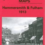 Hammersmith & Fulham 1913 – 86.3
 Putney Bridge & Fulham 1913 – 99.3
 Ealing 1913
Putney 1913 – 113.3
Ealing 1913
Putney 1913 – 113.3
 Dalston 1913 – 40.3
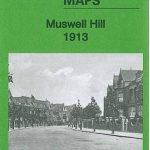 Muswell Hill 1913 – 11.3
Byker and Heaton 1913
Muswell Hill 1913 – 11.3
Byker and Heaton 1913
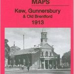 Kew, Gunnersbury & Old Brentford 1913
 Stoke Newington 1868 – 30.1
 Dulwich Village 1913
 Stoke Newington 1914 – 30.3
Stoke Newington 1894 – 30.2
Halesowen (East) 1913 – 5.13b
Bangor 1913 – 6.12
Walthamstow West 1913
Chelsea 1913 – 87.3
Birmingham South 1913
Camberwell & Stockwell 1913 – 102.3
Criccieth 1913
Lower Irlam and Cadishead 1926
Pimlico, Sloane Square & Nine Elms 1913 – 88.3
Stoke Newington 1914 – 30.3
Stoke Newington 1894 – 30.2
Halesowen (East) 1913 – 5.13b
Bangor 1913 – 6.12
Walthamstow West 1913
Chelsea 1913 – 87.3
Birmingham South 1913
Camberwell & Stockwell 1913 – 102.3
Criccieth 1913
Lower Irlam and Cadishead 1926
Pimlico, Sloane Square & Nine Elms 1913 – 88.3
 Clapham Park & Balham 1913 – 125.3
Tynemouth 1913
The Hawthorns 1913
Clapham Park & Balham 1913 – 125.3
Tynemouth 1913
The Hawthorns 1913
 Battersea & Clapham 1913 – 101.3
Bulwell 1913 – 38.05
East Jarrow 1913
Battersea & Clapham 1913 – 101.3
Bulwell 1913 – 38.05
East Jarrow 1913
 Handsworth 1913
Arthur`s Hill and Fenham 1913
Wylde Green 1913
Handsworth 1913
Arthur`s Hill and Fenham 1913
Wylde Green 1913
 Farnham 1913
Tooting 1913 – 134.3
Nottingham NW (New Basford & Hyson Green) 1913 – 38.13
Kentish Town & Camden 1913 – 38.3
Nottingham North 1913
Farnham 1913
Tooting 1913 – 134.3
Nottingham NW (New Basford & Hyson Green) 1913 – 38.13
Kentish Town & Camden 1913 – 38.3
Nottingham North 1913