Disclosure : This site contains affiliate links to products. We may receive a commission for purchases made through these links.
Los Angeles & Southern California ITMB
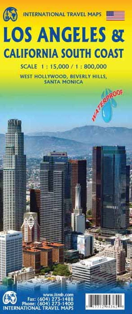
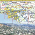
Los Angeles on a very clear, well presented street plan from ITMB, including coverage of West Hollywood, Beverly Hills and Santa Monica, with on the reverse a road map of southern California, printed on light, waterproof and tear-resistant synthetic paper.On one side is a street plan of Los Angeles, extending from the Golden State Freeway in the east, across the Downtown, South Park and Chinatown districts and the Elysian Park, to Hollywood and the Hollywood Hills, with two insets taking the coverage further west to include West Hollywood and Beverly Hills. Another inset provides coverage of the waterfront area from Venice to Santa Monica. Freeways and other main traffic arteries are highlighted, one way streets are indicated and the plan also shows locations of petrol stations. Metro stations are clearly marked, with a separate diagram for the whole subway and LRT network. The plans highlight various places of interest including numerous hotels. The index covers only the main street plan of Downtown L.A. to Hollywood. An overview map of the whole LA conurbation from Long Beach and Santa Ana to San Fernando shows the region’s road network and indicates which areas are covered by the street plans.On the reverse is a road map of southern California at 1:1,000,000 extending across to Las Vegas, and along the coast from San Diego and the Mexican border to San Francisco Bay and inland further north, well beyond Sacramento and Lake Tahoe. Topography is shown by altitude colouring, with peak heights in feet and plenty of names of mountain ranges, passes, etc. National Parks are highlighted. Road network is shown with exit numbers clearly marked on highways and driving distances on main and selected other routes. Railway lines are included and local airports are marked. The map also shows county names and boundaries. Symbols indicate various places of interest, including numerous campsites. The map is indexed and has latitude an longitude lines at intervals of 1ยฐ. An inset shows the San Francisco Bay area in much greater detail at 1:333,000.To see other US regional titles from ITMB please click on the series link.

Related Products:
 California ITMB
 Los Angeles and Hollywood CA Global Graphics Street Map
 Montreal & Southern Quebec ITMB
 Los Angeles CA Rand McNally
 Toronto & Southern Ontario ITMB
 Rome & Southern Italy ITMB
 Munich & Bavaria ITMB
 San Francisco & Northern California ITMB
 Lima & Central Peru ITMB
 California Southern
 Kyoto & Japan West ITMB
 Sydney & Australia East ITMB
 Los Angeles Red Maps
 Zurich & Switzerland NW ITMB
 Los Angeles Borch
 Southern Quebec ITMB
 Vancouver & Greater Vancouver ITMB
Sri Lanka & India South ITMB
Vancouver & Greater Vancouver ITMB
Sri Lanka & India South ITMB
 Tehran & Northern Iran ITMB
 Hungary & Budapest ITMB
 Easter Island & Santiago ITMB
 Accra & Ghana South ITMB
 Santiago & Chile North ITMB
 Los Angeles
 Osaka & Western Japan ITMB
 Moscow ITMB
 Jerusalem & Holy Land ITMB
 Helsinki & Southern Finland ITMB
 Bangkok & Thailand South ITMB
 Southern Ontario ITMB
 Iran & Tehran ITMB
 Tel Aviv-Jaffa & Central Israel ITMB
 Sao Paulo & Brazil South Coast ITMB
 San Diego & USA South West Border ITMB
 Stockholm & Southern Sweden ITMB
 Africa Southern ITMB
 Quito & Central Ecuador ITMB
 Galapagos Islands – Quito & Guayaquil ITMB
 Hong Kong & Region ITMB
 Singapore & Malay Peninsula ITMB