Disclosure : This site contains affiliate links to products. We may receive a commission for purchases made through these links.
Los Angeles & San Diego Vicinity CA Regional Rand McNally
The vicinity of Los Angeles and San Diego at 1:150,000 approx. on a detailed, indexed map from Rand McNally’s regional series covering the environs of main US cities. On one side is the LA conurbation with coverage extending inland to Riverside and Lake Elsinore, north to San Fernando and Moorpark, and along the coast from Malibu to San Clemente. Accompanying inset provides a street plan of downtown Los Angeles. Coverage continues on the other side of the map, from San Clemente and Temecula to the Mexican border and inland to Julian and Pine Valley, with a street plan of downtown San Diego. Each side has a separate index, a list of points of interest, plus a list of freeways. Communities covered by the map include in the LA area: Anaheim, Burbank, Irvine, Laguna Beach, Long Beach, Ontario, Pasadena, Riverside, Thousand Oaks and Torrance, plus in San Diego: Carlsbad, Chula Vista, El Cajon, Encinitas, Imperial Beach, La Jolla, La Mesa, National City, Oceanside, Poway and Vista.Maps in this series present the road network on a clear background with no relief shading to show the area’s topography, but with national or state parks, forests and other protected areas indicated by colouring. Roads are numbered and/or named, showing toll highways, exit numbers of interchanges, services and rest areas. Local airports are marked, but railways and other urban transport lines are not included unless specifically indicated in the individual description. Each town is presented in a different colour, providing those unfamiliar with the region a very clear picture of the area. Various places of interest and facilities are highlighted, including cultural and historical sites, educational institutions, sport and recreational facilities, etc. Each title is indexed. Several maps also include enlargements of the downtown area, plans of international airports, a mileage and driving times diagram for a much wider region than covered by the main map, etc – for more information please see the individual descriptions.To see all the titles in this series please click on the series link.

Related Products:
 Phoenix – Tucson & Vicinity AZ Regional Rand McNally
 San Diego CA Rand McNally
 Indianapolis & Vicinity IN Regional Rand McNally
 Miami – Fort Lauderdale – West Palm Beach FL Regional Rand McNally
 Puget Sound WA Regional Rand McNally
 USA: Rand McNally Regional Maps
 San Francisco Bay Area CA Regional Rand McNally
 Florida Central & Eastern Regional Rand McNally
 Philadelphia & Southeast Pennsylvania Regional Rand McNally
 Pittsburgh Regional PA Rand McNally
 Portland Regional Rand McNally
 Houston TX Regional Rand McNally
 Denver Regional CO Rand McNally
 Los Angeles CA Rand McNally
 Chicago Regional Rand McNally
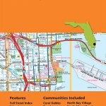
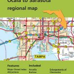 Tampa – St. Petersburg – Ocala to Sarasota Regional Rand McNally
 Detroit & Southeastern Michigan Regional Rand McNally
 New York City & Long Island Regional Rand McNally
 Dallas – Fort Worth Regional TX Rand McNally
 Greater Boston – Eastern Massachusetts Regional Rand McNally
USA: Rand McNally Street Plans / Regional Maps
Greater Boston – Eastern Massachusetts Regional Rand McNally
USA: Rand McNally Street Plans / Regional Maps
 Western United States Easy-to-Read Rand McNally
 California Easy-to-Read Rand McNally
Charlotte NC Rand McNally
California Easy-to-Read Rand McNally
Charlotte NC Rand McNally
 San Diego CA Street Map Global Graphics
 Florida Easy-to-Read Rand McNally
 Miami FL Rand McNally
 Fort Lauderdale Metro FL Rand McNally
 Chicago IL Rand McNally
 California Southern Easy to Fold Rand McNally
 San Diego & USA South West Border ITMB
 Orlando FL Rand McNally
 Philadelphia PA Rand McNally
 Los Angeles & Southern California ITMB
 Houston TX Rand McNally
 San Diego County CA Freeway System and Major Streets Global Graphics
 Missouri Easy-to-Read Rand McNally
 Delaware & Maryland Easy-to-Read Rand McNally
 Sacramento CA Rand McNally
 Phoenix AZ Rand McNally