Disclosure : This site contains affiliate links to products. We may receive a commission for purchases made through these links.
Longyearbyen and surroundings
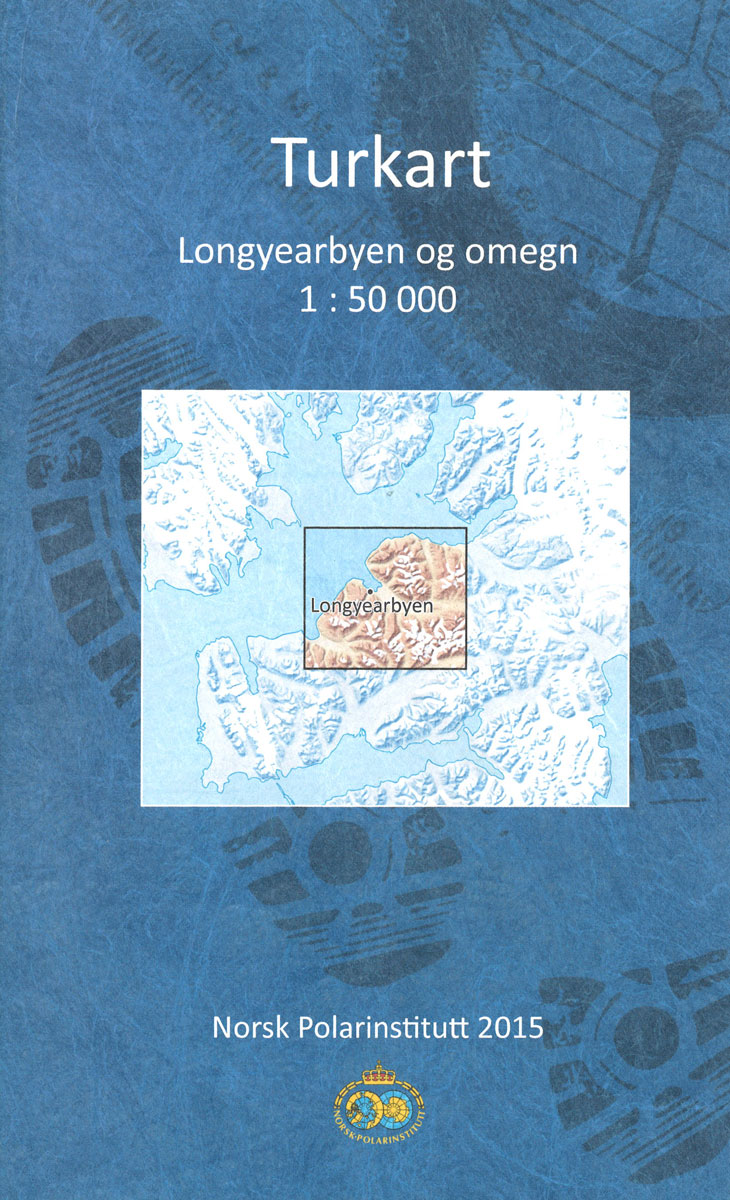
Detailed topographic map of Nordenskiรถld Land, the central part of Spitsbergen, which includes the main town Longyearbyen. The map has contours at 50-metre intervals and shows settlements and isolated houses or huts, roads, snow-scooter tracks, airfields and landing grounds, lighthouses, working and disused mines, etc. Danger spots are clearly marked.The map has a UTM grid, with margin ticks for latitude in steps of 20` and longitude at 15`. Map legend includes English.

Related Products:
 Nordenskiรถld Land
 Bjornoya
 Merano and Surroundings Freytag & Berndt Map
 Vaigattbogen
Hinlopenbreen
Austfjorden
Woodfjorden
Eidsvollfjellet
Sjuรธyane
Rijpfjorden
Snรธtoppen
Mosselhalvรธya
ร…sgรฅrdfonna
Nordenskiรถldbukta
Storsteinhalvรธya
Gotiahalvรธya
St. Johnsfjorden
Tre Kroner
Adventdalen
Negribreen
Dicksonfjorden
Van Mijenfjorden
Isfjorden
Agardhfjellet
Kongsfjorden
Magdalenefjorden
Krossfjorden
Reinsdyrflya
Braganzavรฅgen
Vasahalvรธya
Prins Karls Forland
Vaigattbogen
Hinlopenbreen
Austfjorden
Woodfjorden
Eidsvollfjellet
Sjuรธyane
Rijpfjorden
Snรธtoppen
Mosselhalvรธya
ร…sgรฅrdfonna
Nordenskiรถldbukta
Storsteinhalvรธya
Gotiahalvรธya
St. Johnsfjorden
Tre Kroner
Adventdalen
Negribreen
Dicksonfjorden
Van Mijenfjorden
Isfjorden
Agardhfjellet
Kongsfjorden
Magdalenefjorden
Krossfjorden
Reinsdyrflya
Braganzavรฅgen
Vasahalvรธya
Prins Karls Forland
 Madrid and Surroundings CNIG Map
 Sanabria Lake and Surroundings NP CNIG Map
 Berne and Surroundings Swisstopo 2502
Norway: 100K Topographic Survey of Svalbard/Spitsbergen
Berne and Surroundings Swisstopo 2502
Norway: 100K Topographic Survey of Svalbard/Spitsbergen
 California – Hawaii Lighthouses Bella Terra Illustrated Map
 Mid-Atlantic Lighthouses Bella Terra Illustrated Map
 Svalbard North
 Florida Lighthouses Bella Terra Illustrated Map
Svalbard South-East
Florida Lighthouses Bella Terra Illustrated Map
Svalbard South-East