Disclosure : This site contains affiliate links to products. We may receive a commission for purchases made through these links.
Longbridge 1937

Longbridge in 1937 in a fascinating series of reproductions of old Ordnance Survey plans in the Alan Godfrey Editions, ideal for anyone interested in the history of their neighbourhood or family. The map covers much of Longbridge; the dominant feature are the Longbridge Motor Works, including the large test track. Coverage extends westward to Leach Heath and part of Rednal. Other features include a stretch of LMS railway with part of the Halesowen Joint Line with Longbridge station, Lickey Road with tramway, Bristol Road South with tramway, Cofton Park, Nazareth House, Leach Heath, northern tip of Lickey Hills, Agatha Stacy Homes, part of Rubery Hill Mental Hospital, quarries, etc. On the reverse is a directory of Lickey, plus a timetable for the Halesowen to Kings Norton line. About the Alan Godfrey Editions of the 25″ OS Series:Selected towns in Great Britain and Ireland are covered by maps showing the extent of urban development in the last decades of the 19th and early 20th century. The plans have been taken from the Ordnance Survey mapping and reprinted at about 15 inches to one mile (1:4,340). On the reverse most maps have historical notes and many also include extracts from contemporary directories. Most maps cover about one mile (1.6kms) north/south, one and a half miles (2.4kms) across; adjoining sheets can be combined to provide wider coverage.FOR MORE INFORMATION AND A COMPLETE LIST OF ALL AVAILABLE TITLES PLEASE CLICK ON THE SERIES LINK.

Related Products:
 Halesowen (East) 1913 – 5.13b
Trafford Park South 1937
Halesowen (East) 1913 – 5.13b
Trafford Park South 1937
 Halesowen (West) 1901 – 4.16
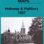 Holloway & Highbury 1937 – 29.4
Pwllheli 1914
Holloway & Highbury 1937 – 29.4
Pwllheli 1914
 Hampstead 1866 – 27.1
Sunderland South 1895
Swiss Cottage & South Hampstead 1937 – 37.4
Hampstead 1866 – 27.1
Sunderland South 1895
Swiss Cottage & South Hampstead 1937 – 37.4
 Cheadle and Cheadle Heath 1897
Coombeswood 1914
Cheadle and Cheadle Heath 1897
Coombeswood 1914
 Hampstead 1915 – 27.3
Cradley South 1901
Hampstead 1915 – 27.3
Cradley South 1901
 Bexley Heath 1862
Warley 1902
Bishopbriggs 1910
Bexley Heath 1862
Warley 1902
Bishopbriggs 1910
 Tong 1905
Rothesay 1886 – 204.06
Tong 1905
Rothesay 1886 – 204.06
 South Norwood 1895
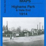 Highams Park and Hale End 1915 – 78.01
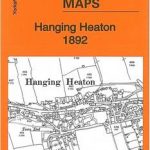 Hanging Heaton 1892
 South Croydon 1895 – 14.14
 South Croydon 1895 – 159.2
Jarrow 1912
Pedmore 1921
South Croydon 1895 – 159.2
Jarrow 1912
Pedmore 1921
 Beckenham South 1894
 Warwick North 1923
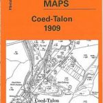 Coed-Talon 1909
Worcester South-West 1902
Coed-Talon 1909
Worcester South-West 1902
 Goathland 1910 – 45.16
Thornton Heath and Norbury 1894
Fallowfield 1904
Low Fell 1895
Harton 1895
Luton 1922 – 33.05
Eston 1927
Blackpool Central Pier 1909
Sandwell Hall 1902
Bamfurlong and Bryn Gates 1906
Goathland 1910 – 45.16
Thornton Heath and Norbury 1894
Fallowfield 1904
Low Fell 1895
Harton 1895
Luton 1922 – 33.05
Eston 1927
Blackpool Central Pier 1909
Sandwell Hall 1902
Bamfurlong and Bryn Gates 1906
 Lostock Junction 1907
West Twickenham & Strawberry Hill 1894 – 121a
Lostock Junction 1907
West Twickenham & Strawberry Hill 1894 – 121a