Disclosure : This site contains affiliate links to products. We may receive a commission for purchases made through these links.
London: Hammersmith and Fulham Borough Map – Stanfords Print on Demand

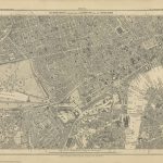
Hammersmith and Fulham in the Stanfords Maps of London Boroughs (PRINT ON DEMAND/FLAT MAPS) is produced in-house by the digital department at our Long Acre store and has been designed by laying a bespoke, tailored borough map onto on a base map using Ordnance Survey Street View mapping. The borough area is represented by a colour map, with the surrounding area of neighbouring boroughs shown in greyscale background. Hammersmith and Fulham in the Stanfords Maps of London Boroughs measures 91x128cm and is presented at a scale of approximately 1:7200.

Related Products:
 London: Greenwich Borough Map – Stanfords Print on Demand
 London: Hillingdon Borough Map – Stanfords Print on Demand
 London: Redbridge Borough Map – Stanfords Print on Demand
London: Bexley Borough Map – Stanfords Print on Demand
London: Hounslow Borough Map – Stanfords Print on Demand
London: City of London Borough Map – Stanfords Print on Demand
London: Redbridge Borough Map – Stanfords Print on Demand
London: Bexley Borough Map – Stanfords Print on Demand
London: Hounslow Borough Map – Stanfords Print on Demand
London: City of London Borough Map – Stanfords Print on Demand
 London: Lambeth Borough Map – Stanfords Print on Demand
London: Camden Borough Map – Stanfords Print on Demand
London: Lambeth Borough Map – Stanfords Print on Demand
London: Camden Borough Map – Stanfords Print on Demand
 London: Islington Borough Map – Stanfords Print on Demand
London: Southwark Borough Map – Stanfords Print on Demand
London: Westminster Borough Map – Stanfords Print on Demand
London: Hackney Borough Map – Stanfords Print on Demand
London: Wandsworth Borough Map – Stanfords Print on Demand
London: Islington Borough Map – Stanfords Print on Demand
London: Southwark Borough Map – Stanfords Print on Demand
London: Westminster Borough Map – Stanfords Print on Demand
London: Hackney Borough Map – Stanfords Print on Demand
London: Wandsworth Borough Map – Stanfords Print on Demand
 London: Newham Borough Map – Stanfords Print on Demand
 London: Haringey Borough Map – Stanfords Print on Demand
London: Merton Borough Map – Stanfords Print on Demand
London: Ealing Borough Map – Stanfords Print on Demand
London: Lewisham Borough Map – Stanfords Print on Demand
London: Sutton Borough Map – Stanfords Print on Demand
London: Haringey Borough Map – Stanfords Print on Demand
London: Merton Borough Map – Stanfords Print on Demand
London: Ealing Borough Map – Stanfords Print on Demand
London: Lewisham Borough Map – Stanfords Print on Demand
London: Sutton Borough Map – Stanfords Print on Demand
 London: Richmond upon Thames Borough Map – Stanfords Print on Demand
London: Kensington and Chelsea Borough Map – Stanfords Print on Demand
London: Tower Hamlets Borough Map – Stanfords Print on Demand
London: Bromley (Northern Sheet) Borough Map – Stanfords Print on Demand
London: Bromley (Southern Sheet) Borough Map – Stanfords Print on Demand
London: Havering (Northern Sheet) Borough Map – Stanfords Print on Demand
London: Havering (Southern Sheet) Borough Map – Stanfords Print on Demand
London: Barnet (Southern Sheet) Borough Map – Stanfords Print on Demand
London: Barnet (Northern Sheet) Borough Map – Stanfords Print on Demand
Stanfords Maps of London Boroughs (PRINT ON DEMAND/FLAT MAPS)
London Boroughs Poster Map – Stanfords Print on Demand
London: Richmond upon Thames Borough Map – Stanfords Print on Demand
London: Kensington and Chelsea Borough Map – Stanfords Print on Demand
London: Tower Hamlets Borough Map – Stanfords Print on Demand
London: Bromley (Northern Sheet) Borough Map – Stanfords Print on Demand
London: Bromley (Southern Sheet) Borough Map – Stanfords Print on Demand
London: Havering (Northern Sheet) Borough Map – Stanfords Print on Demand
London: Havering (Southern Sheet) Borough Map – Stanfords Print on Demand
London: Barnet (Southern Sheet) Borough Map – Stanfords Print on Demand
London: Barnet (Northern Sheet) Borough Map – Stanfords Print on Demand
Stanfords Maps of London Boroughs (PRINT ON DEMAND/FLAT MAPS)
London Boroughs Poster Map – Stanfords Print on Demand
 Hammersmith & Fulham 1894 – 86.2
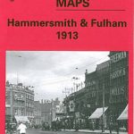 Hammersmith & Fulham 1913 – 86.3
 Hammersmith & Fulham 1871 – 86.1
 Stanfords Tube Maps (PRINT ON DEMAND/FLAT MAPS)
 Stanford`s Map of the County of London (1888) – A1 Wall Map, Paper – Print on Demand
 Stanfords Tube & Railway Map (Central London) – VERSION C
Stanfords Tube & Railway Map (Central London Small) – VERSION C
Stanfords Tube & Railway Map (Central London) – VERSION C
Stanfords Tube & Railway Map (Central London Small) – VERSION C
 Stanford`s New Two Inch Map of London (1913) – A2 Wall Map, Canvas – Print on Demand
 North London Three Borough Challenge Walk – Enfield, Barnet and Haringey
 Stanford`s Library Map of London Sheet 10 Black and White (1862) – A3 Wall Map, Paper – Print on Demand