Disclosure : This site contains affiliate links to products. We may receive a commission for purchases made through these links.
London Collins Handy Street Map

Clear and easy-to-read map of central London and surrounding area. Contains detailed mapping, presented in a handy compact format. This attractive map, ideal for both tourists and residents, and fully updated, has an extensive area of coverage and displays a wealth of detail. INCLUDES* New for this edition: Electric car recharging sites* Fully classified roads.* Colour-coded buildings.* Postal districts and boundaries clearly depicted.* Full indexes to street names (on back of map), place names and places of interest.* Fully updated London underground map conveniently located on the back cover. AREA OF COVERAGEExtends from Hampstead in the north to Clapham in the south and from Hammersmith in the west to Greenwich in the east. SCALE1:17,500 (3.6 inches to 1 mile).

Related Products:
 London Collins Pocket Atlas
 Greater London Collins Street Atlas
 London Philip`s Mini Street Atlas
 London A-Z Big Street Atlas
 London Philip`s Street Atlas De Luxe Edition Union Jack
 London A-Z Street Atlas
 Scotland Collins Handy Road Atlas
 London: Philip`s Street Atlases
 Ireland Collins Handy Road Atlas
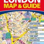 The Handy London Bensons Map & Guide
 Discovering London Street Names
 London A-Z Mini Street Atlas PAPERBACK
 Scotland Collins Road Map 2023
 London Collins Pocket Map
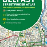 Belfast Collins Streetfinder Colour Atlas
 London: A-Z Street Atlases and Maps
 Ireland Collins Handy Map
 Discovering London Collins Illustrated Map
 London High 5 Edition Street Plan
 London West End A-Z Mini Map
 London Underground Mini Map Streetwise
 London Bensons MapGuides Street Map
 Dublin Collins Streetfinder Colour Map
 Germany: ADAC Regional Street Atlases
 Britain and Ireland Collins Handy Road Atlas 2022 A5 SPIRAL-BOUND
 Britain and Ireland Collins Handy Road Atlas 2021 A5 SPIRAL-BOUND
 London Graffiti and Street Art: Unique Artwork from London`s Streets
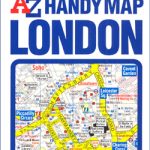 London A-Z Handy Map
 Ireland Collins Road Map 2021
 Hamburg – Lรผbeck – Lรผneburg ADAC Street Atlas
 London: Bensons MapGuides Street Plans and Atlases
Britain and Ireland Collins Handy Road Atlas 2023 A5 SPIRAL-BOUND
London: Bensons MapGuides Street Plans and Atlases
Britain and Ireland Collins Handy Road Atlas 2023 A5 SPIRAL-BOUND
 Christchurch Visitors` Street Plan
 Hanover – Hildesheim – Celle ADAC Street Atlas
 London Street Trees
 Saarland – West Palatinate ADAC Street Atlas
Berlin – Potsdam Region ADAC Street Atlas
Saarland – West Palatinate ADAC Street Atlas
Berlin – Potsdam Region ADAC Street Atlas
 Cologne – Bonn – Aachen – Koblenz – Leverkusen ADAC Street Atlas
 Munich – Augsburg – Erding – Ingolstadt – Landshut ADAC Street Atlas
 Nuremberg – Ansbach – Bamberg – Bayreuth – Erlangen – Fรผrth ADAC Street Atlas