Disclosure : This site contains affiliate links to products. We may receive a commission for purchases made through these links.
London: Bensons MapGuides Street Plans and Atlases
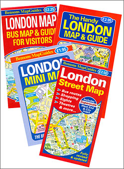
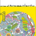
Central London covered by a range of titles from Bensons MapGuides, publishers of the clearest, most accurate and most informative street mapping of the capital, particularly for those who wish to explore London on foot.The same style of presentation of the street network is used in different titles with varying degree of detail. Excellent placing of names and the use of colours or symbols enable the publishers to provide a wealth of information whilst retaining the clarity of small detail: streets with bus services, Underground/railway stations and riverboat piers, prime shopping areas, places of entertainment and main services, selected hotels and pubs, etc. The capitalโ€s main sights are prominently highlighted and other important buildings are named. For drivers the maps indicate main traffic routes and show entry restrictions for motorized traffic and car parks. One way streets are not marked.For those exploring London on foot the Bensons plans offer information not often found on other street maps: small passages, steps or stairways, foot access onto bridges from streets below them, etc.Additional panels, varying from title to title, provide more information: enlargements of the West End and the City, bus routes, places of entertainment, descriptions of sights, sightseeing walks, a shopping guide, etc.For more information please see the individual description. The most detailed coverage is offered by the London Street Map.

Related Products:
 London Bensons MapGuides Street Map
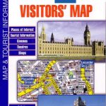
 Map of London Bensons MapGuides
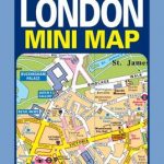 London Mini Map Bensons MapGuides
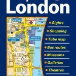
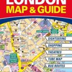 The Handy London Bensons Map & Guide
 London Bensons MapGuides Bus Map & Guide for Visitors
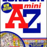
 London: A-Z Street Atlases and Maps
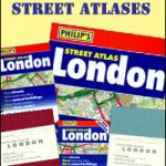 London: Philip`s Street Atlases
 USA: Rand McNally Street Plans / Regional Maps
 France: IGN Street Plans
 Great Britain: A-Z Towns and Cities Street Atlases
 Netherlands/Belgium: Falk Citymap & More Pocket Street Plans
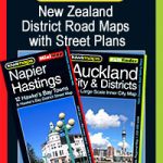 New Zealand: Kiwimaps District Road Maps with Street Plans
 France: Blay-Foldex Street Plans
 London Philip`s Mini Street Atlas
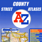 Great Britain: A-Z County Street Atlases
 Red Maps Street Plans
 Germany: ADAC Regional Street Atlases
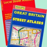 Great Britain: Philip`s City Street Atlases
 London A-Z Street Atlas
 London A-Z Big Street Atlas
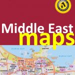 Middle East: Explorer Publishing Maps, Atlases and Street Plans
 Michelin “Write & Wipe” Tourist Street Plans
 London Graffiti and Street Art: Unique Artwork from London`s Streets
 Mexico: Ed. Independecia State Road Maps and Street Plans
 London A-Z Mini Street Atlas PAPERBACK
 London Street Trees
 London Street Furniture
 Galway OSI Street Map
 Sofia Domino Street Plan
 Freytag & Berndt City Pocket Street Plans
 Santiago de Chile Trekkingchile Street Plan
 Great Britain & Northern Ireland: Philip`s County Street Atlases
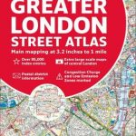 Greater London Collins Street Atlas
 London all-on-one Transport Map
 Congo Cities Map (10 Street Plans)
 Cesky Krumlov and Prachatice Street Plans
 Basel Pocket Street Plan
 Mumbai (Bombay) Street Atlas
 Great Britain: A-Z Visitors` Maps and Atlases