Disclosure : This site contains affiliate links to products. We may receive a commission for purchases made through these links.
London A-Z Mini Street Atlas PAPERBACK
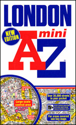
A-Z Mini Atlas of London in a pocket-size, paperback format at 1:21,477 (3″ to 1 mile), with central London also shown at 1:10,560 (6″ to 1 mile). Additional plates show access to London’s Congestion Zone and a diagram of the Transport for London network. The atlas also has an additional index of all the tube, Overground, DLR, tramlink, riverbus and railway stations. Current edition of this title was published in 2013. This title is also available in a spiral-bound format ‘“ to see the full list of A-Z street atlases and maps of London, please click on the series link.A-Z street atlases of London use the same basic cartography, enlarged or reduced according to the requirements of each title, so the print size of street names and other named features will vary according to the map scale. The mapping show A and B roads with route numbers, indicating as appropriate selected house number of easier identification of addresses. One way streets are marked and on A road, where useful, traffic flow direction. Colouring also indicates pedestrianized or restricted access streets and the maps show Congestion Charging Zone boundary, selected car parks, park & ride facilities and locations of speed cameras. In addition of railway and London Transport stations, the maps also show tramlink routes with stops, and river bus stops. Colouring indicates various types of buildings: places of interest, shopping centres and markets, leisure facilities, medical centres, etc. Also marked are public toilets, indicating facilities of disabled users.Unless indicated to the contrary, the index shows districts and various facilities or places of interest in colour to make them easy to see. All versions all include a diagram of London Transport’s Underground/Overground/DLR network. Stanford’s presentation of the individual atlases includes an image showing the extent of the coverage.Street maps adapt the basic cartography to present various aspects of capital. Forpublication dates and other special features of each title please see the individual description.

Related Products:
 London: A-Z Street Atlases and Maps
 London Philip`s Mini Street Atlas
 London A-Z Big Street Atlas
 London A-Z Premier Map
 London A-Z Premier Map WATERPROOF
 London A-Z Street Atlas
 Hamburg – Lรผbeck – Lรผneburg ADAC Street Atlas
 Hanover – Hildesheim – Celle ADAC Street Atlas
 Saarland – West Palatinate ADAC Street Atlas
 Berlin – Potsdam Region ADAC Street Atlas
 Cologne – Bonn – Aachen – Koblenz – Leverkusen ADAC Street Atlas
 Munich – Augsburg – Erding – Ingolstadt – Landshut ADAC Street Atlas
 Nuremberg – Ansbach – Bamberg – Bayreuth – Erlangen – Fรผrth ADAC Street Atlas
 Stuttgart – Heilbronn – Gรถppingen – Pforzheim – Reutlingen – Rottweil ADAC Street Atlas
Rhine-Main – Frankfurt – Aschaffenburg – Darmstadt – Mainz – Wiesbaden ADAC Street Atlas
Stuttgart – Heilbronn – Gรถppingen – Pforzheim – Reutlingen – Rottweil ADAC Street Atlas
Rhine-Main – Frankfurt – Aschaffenburg – Darmstadt – Mainz – Wiesbaden ADAC Street Atlas
 London: Philip`s Street Atlases
 East Westphalia – Lippe – Bielefeld – Detmold – Gรผtersloh – Minden – Paderborn ADAC Street Atlas
 Rhine-Ruhr – Bochum – Dortmund – Duisburg – Essen – Mรผnster ADAC Street Atlas
 London Philip`s Street Atlas De Luxe Edition Union Jack
 London A-Z Visitor`s Atlas & Guide
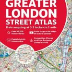 Greater London Collins Street Atlas
Germany: ADAC Regional Street Atlases
Greater London Collins Street Atlas
Germany: ADAC Regional Street Atlases
 Ontario Western Street Atlas
 Surrey A-Z Street Atlas
 Nottinghamshire A-Z County Street Atlas
 Australia Hema Road & 4WD Atlas PAPERBACK
 Greater London A-Z Master Atlas
 West Yorkshire – Leeds – Bradford A-Z Street Atlas
 West Midlands – Birmingham – Coventry – Wolverhampton A-Z Street Atlas
 West Sussex A-Z Street Atlas
 Mumbai (Bombay) Street Atlas
 London: Bensons MapGuides Street Plans and Atlases
 Bolton – Bury A-Z Street Atlas
 Chennai / Madras Street Atlas
 Ontario Northern and Cottage Country Street Atlas
 Winnipeg Pocket Street Atlas
 Winnipeg and Area Street Atlas
 Bristol – Bath A-Z Street Atlas
 Bournemouth – Poole – Christchurch A-Z Street Atlas
 Derbyshire Philip`s Street Atlas