Disclosure : This site contains affiliate links to products. We may receive a commission for purchases made through these links.
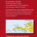
Lofoten Nordeca Tourist Route 20014
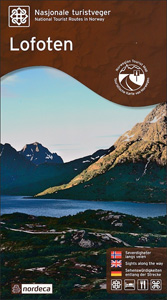
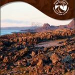
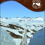
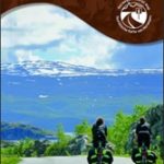
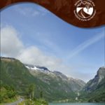
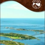
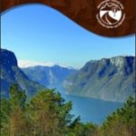
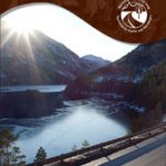
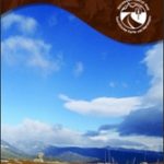
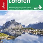
This Lofoten National Tourist Route Map belongs to a series of 18 map and postcards sets describing popular tourist routes all over Norway. The map set includes a map in 1: 100,000 presenting an accurate topography (based on the Norwegian topographic survey) which describes local footpaths, cycle or ski routes, sport and recreational facilities, places of interest, places to stay and eat, viewpoints.The Lofoten National Tourist Route in the county of Nordland is a 230 kilometre-long stretch of road between the bridge across Raftsundet in the north and ร… in the south. Svolvรฆr and Leknes are the two urban centres in the area.This national tourist route takes you through Lofoten`s distinctive and stunning scenery – a contrast of craggy peaks, white beaches and emerald green sea. The tidal currents between the islands are at the base of Lofoten`s important fishing industry and its rich cultural traditions. Along the shores are many fishing hamlets with their characteristic rorbuer (fishermen’s cabins). Every year the wonders of nature and the living coastal culture attract thousands of visitors, filling the brief weeks of summer with life and sound – and the midnight sun. There are many opportunities for activities at sea and in the mountains, but the Lofoten Islands are also a place of peace and quiet. Winter is the best time for Lofoten fishery, for the skrei (winter cod) in particular, which still means so much for the local settlements.Getting around the islands by car or cycle is easy. From Bodรธ and Moskenes there are boats to the island communities of Vรฆrรธy and Rรธst, the last settlements before the open sea. The rocks south of Rรธst are the nesting sites for millions of seabirds. Whales, seals and killer whales are also to be seen in the area, and organised boat trips give you the chance to sea birds and sea animals at close range.Several descriptions and illustrations are included in the map to deliver a good visual representation of the trip.The set features:One map: scale 1:100,000 Text in three languages (Norwegian, English and German)5 Postcards (13.5x25cm)To see the list of other titles in this series, please click on the series link.

Related Products:
 Havoysund Nordeca Tourist Route 20017
 Varanger Nordeca Tourist Route 20018
 Sognefjellet Nordeca Tourist Route 20008
 Helgeland Coast North Nordeca Tourist Route 20013
 Gaularfjellet Nordeca Tourist Route 20007
 Atlantic Road Nordeca Tourist Route 20012
 Old Strynefjellsvegen Nordeca Tourist Route 20009
 Lofoten West Nordeca 2745
 Lofoten Nordeca 2549
 Aurlandsfjellet Nordeca Tourist Route 20005
 Ryfylke Nordeca Tourist Route 20002
 Valdresflye Nordeca Tourist Route 20006
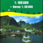 Lofoten – Vaeroy
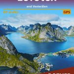
 Lofoten and Vesteralen Islands
 Vestvรฅgรธy Nordeca 2673
 Lofoten Climbs Rockfax: Rock Climbing on Lofoten and Stetind in Arctic Norway
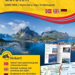 Lofoten Nordeca Sightseeing Map 6022
 Denmark Tourist Map – Major Cities with the Marguerite Route
 Lofoten and Vesterรฅlen Rother Guide
 Central and North Norway: Bodรธ – Lofoten
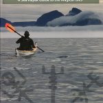 The Lofoten Islands – A Sea Kayak Guide to the Magical Isles
 Vagan Nordeca 2671
 Tour de Manche Vol. 1: North-West Normandy – Channel Is. – South Dorset Cycle Route (505km)
 Lofoten PhoneMaps Outdoor Map 104
 Lofoten – Vesteralen Islands – Senja Cappelen Sectional Road Map
 Vesteralen – Hinnoya South Nordeca 2811
 Oslo Nordmark WINTER edition Nordeca 2425
 Danube-Lake Constance Cycle Route – Upper Swabia-Allgรคu Cycle Route Bikeline Map-Guide
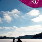
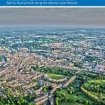 Bath to Bournemouth Sustrans Cycle Route Map
Garden Route & Route 62 Map Studio
Bath to Bournemouth Sustrans Cycle Route Map
Garden Route & Route 62 Map Studio
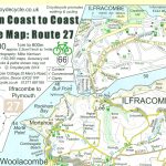 Devon Coast to Coast – Route 27 Cycle Map 66
 Munich-Venice Long Distance Cycle Route – incl Dolomites Route Bikeline Map-Guide
Egertal Cycle Route – Ohre Cycle Route Bikeline Map-Guide Compact
Munich-Venice Long Distance Cycle Route – incl Dolomites Route Bikeline Map-Guide
Egertal Cycle Route – Ohre Cycle Route Bikeline Map-Guide Compact
 Romsdalsfjella South Nordeca 2822
 Stromberg-Murrtal Cycle Route – Idyllic Route
 Femunden South Nordeca 2722
 Way of the roses: The official guide to the national cycle network coast to coast cycle route from Morecambe to Bridlington
 Iller Cycle Route – Zusam Cycle Route Bikeline Map-Guide
 Finnskogen South Nordeca 2676
 Trollheimen South Nordeca 2828