Disclosure : This site contains affiliate links to products. We may receive a commission for purchases made through these links.
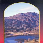
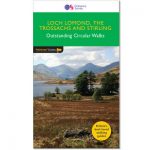
Loch Lomond & the Trossachs National Park Outdoor Atlas
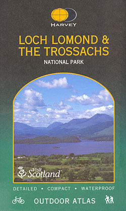
Lomond & the Trossachs National Park in an indexed, A5 size, spiral-bound recreational atlas at 1:40,000 from Harvey Map Services, with additional street plans, overview maps showing local peaks or the transport links, lists of Munros and lochs, etc. Topography is shown by contours at 15m intervals, with additional colouring and/or graphics for altitude and vegetation (pastures, forests and plantations, fell or moorland, etc. Munros, Corbetts and Grahams (hills over 3000, 2500 and 2000 feet respectively) are indicated. The maps show local paths, highlighting long-distance trails, and waymarked cycle routes. Symbols indicate various facilities and places of interest, including campsites and caravan parks, youth hostels and bunkhouses, tea rooms and pubs, car parks and information points, etc. Each page has the lines of the British National Grid. The index has separate lists of settlements, Munros/etc, Lochs and Glens.Street plans of several local villages show what facilities can be found there. Overview map show public transport network, Munros/Corbetts/Grahams, and long-distance hiking or cycling trails/visitor centres, etc. Current edition of this title was published in 2005.

Related Products:
 Walking Loch Lomond and the Trossachs: 70 walks, including 21 Munro summits
 Loch Lomond & The Trossachs Harvey Ultramap XT40
 Loch Lomond National Park Collins Pocket Map
 Eifel National Park – Ahrtal K+F Outdoor Map 19
 Mรผritz National Park – Waren – Plauer See – Neusterlitz K+F Outdoor Map 16
 PaddleMore in Loch Lomond and The Trossachs: A Guide for Canoes, Kayaks and SUPs
 The Great Trossachs Path Harvey National Trail XT40
 South Loch Ness Trail Harvey National Trail XT40
 Day Walks in Loch Lomond & the Trossachs: 20 routes in the southern Scottish Highlands
 Loch Lomond & The Trossachs – Ben Lomond & Loch Katrine Harvey Superwalker XT25
 Walks around West Loch Lomond & Clyde Sea Lochs
 Kecskemรฉt (with Kiskunsรกg National Park)
 Ben Venue – Loch Ard Forest & the Trossachs Harvey Superwalker
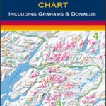 Munro & Corbett Chart
 USA Rand McNally Road Atlas & National Park Guide 2022 A3 SPIRAL-BOUND
 Loch Lomond & the Trossachs V1: West
 Lochside Walks: The Finest Waterside Walks in Loch Lomond & the Trossachs
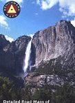 Yosemite National Park Area
 Hill Walks & Easy Summits: Walks on the Lower Hills of Loch Lomond & the Trossachs
 Bavarian Forest National Park – Nature Park East UK50-29
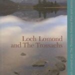 Loch Lomond and The Trossachs
 Elbsandsteingebirge ‘“ Sรคchsische Schweiz National Park K+F Map 18
Cotswold Way Harvey National Trail XT40
Elbsandsteingebirge ‘“ Sรคchsische Schweiz National Park K+F Map 18
Cotswold Way Harvey National Trail XT40
 Cumbria Way Harvey National Trail XT40
Slowinski National Park ExpressMap Tourist Map
Cumbria Way Harvey National Trail XT40
Slowinski National Park ExpressMap Tourist Map
 Loch Lomond & Trossachs Mazzle – Jigsaw 1000 Pieces
 South Downs Way Harvey National Trail XT40
 Loch Lomond, The Trossachs: 2016
 St Cuthbert`s Way Harvey National Trail XT40
 Gesรคuse National Park Kompass 206
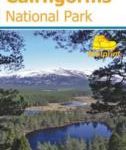 Discover Cairngorms National Park
 Khumbu – Sagarmatha National Park
 Kampinoski National Park
 Galicica National Park
 Kruger National Park Map Studio Visitor`s Guide & Atlas
 Torres del Paine: Chile`s Premier National Park and Argentina`s Los Glaciares National Park
 Dales Way Harvey National Trail XT40
 Loch Lomond North – Tyndrum, Crianlarich & Arrochar OS Explorer Map OL39 (paper)
 Great Glen Way Harvey National Trail XT40
 Loch Lomond South – Dumbarton, Helensburgh, Drymen & Cove OS Explorer Map OL38 (paper)