Disclosure : This site contains affiliate links to products. We may receive a commission for purchases made through these links.
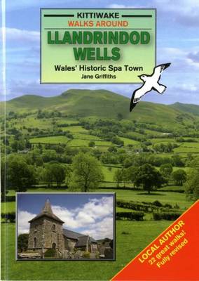
Llandrindod Wells

Related Products:
 Llandrindod Wells & Elan Valley – Rhayader OS Explorer Map 200 (paper)
 Llandrindod Wells & Elan Valley – Rhayader OS Active Explorer Map 200 (waterproof)
 The Kent Ramblers Guide to the Tunbridge Wells Circular Walk and Other Walks in the Tunbridge Wells Area
 The Young H.G. Wells: Changing the World
 Elan Valley & Builth Wells OS Landranger Map 147 (paper)
 Weston-super-Mare, Bridgwater & Wells OS Landranger Map 182 (paper)
 Elan Valley & Builth Wells OS Landranger Active Map 147 (waterproof)
 CHS Chart 6419 – Norman Wells to Carcajou Ridge Kilometre 910-980
 Maidstone, Royal Tunbridge Wells, Sevenoaks & Tonbridge OS Landranger Map 188 (paper)
 Weston-super-Mare, Bridgwater & Wells OS Landranger Active Map 182 (waterproof)
 Maidstone, Royal Tunbridge Wells, Sevenoaks & Tonbridge OS Landranger Active Map 188 (waterproof)
 CHS Chart 6418 – Norman Wells, Halfway Islands to Rader Island Kilometre 850-920
 C28 Harwich to Wells-next-the-Sea
Malvern Wells 1903
C28 Harwich to Wells-next-the-Sea
Malvern Wells 1903
 Wells Gray – Murtle Lake ITMB
Tunbridge Wells and Ashdown Forest 1894
Wells Gray – Murtle Lake ITMB
Tunbridge Wells and Ashdown Forest 1894
 Admiralty Chart SC5614_7 – Cromer to Wells-next-the-Sea
 Admiralty Chart 108 – Approaches to The Wash, Wells-Next-The-Sea
 Builth Wells, Painscastle & Talgarth OS Explorer Map 188 (paper)
 Llandovery, Llanwrtyd Wells & Llyn Brianne OS Explorer Map 187 (paper)
 Ludlow – Tenbury Wells & Cleobury Mortimer OS Explorer Map 203 (paper)
 Norfolk Coast Central – Wells-next-the-Sea & Fakenham OS Explorer Map 251 (paper)
 Builth Wells, Painscastle & Talgarth OS Explorer Active Map 188 (waterproof)
 Sevenoaks & Tonbridge – Royal Tunbridge Wells & Westerham OS Explorer Map 147 (paper)
 Llandovery, Llanwrtyd Wells & Llyn Brianne OS Explorer Active Map 187 (waterproof)
 Ludlow – Tenbury Wells & Cleobury Mortimer OS Explorer Active Map 203 (waterproof)
 Norfolk Coast Central – Wells-next-the-Sea & Fakenham OS Explorer Active Map 251 (waterproof)
 Cheddar Gorge & Mendip Hills West – Wells & Glastonbury OS Explorer Map 141 (paper)
 Sevenoaks & Tonbridge – Royal Tunbridge Wells & Westerham OS Explorer Active Map 147 (waterproof)
 Cheddar Gorge & Mendip Hills West – Wells & Glastonbury OS Explorer Active Map 141 (waterproof)
 High Weald – Royal Tunbridge Wells, Cranbrook, Hawkhurst & Bewl Water OS Explorer Map 136 (paper)
 Ashdown Forest – Royal Tunbridge Wells, East Grinstead, Haywards Heath & Crowborough OS Explorer Map 135 (paper)
 High Weald – Royal Tunbridge Wells, Cranbrook, Hawkhurst & Bewl Water OS Explorer Active Map 136 (waterproof)
 Ashdown Forest – Royal Tunbridge Wells, East Grinstead, Haywards Heath & Crowborough OS Explorer Active Map 135 (waterproof)
 NOAA Chart 16711 – Port Wells including College Fiord and Harriman Fiord
 NOAA Chart 13286 – Cape Elizabeth to Portsmouth – Cape Porpoise Harbor – Wells Harbor – Kennebunk River – Perkins Cove