Disclosure : This site contains affiliate links to products. We may receive a commission for purchases made through these links.
Liverpool Edge Hill 1905
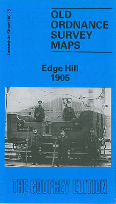
Edge Hill in 1905 in a fascinating series of reproductions of old Ordnance Survey plans in the Alan Godfrey Editions, ideal for anyone interested in the history of their neighbourhood or family. The map covers a major area of east Liverpool, stretching from Grove Street eastward to Wavertree station, and from Edge Lane southward to Rosebery Street. Features include Wavertree Park, Edge Hill station, Spekeland Road Depot, engine shed; numerous junctions, sidings and depots; Botanic Gardens, north end of Toxteth Park Cemetery, Phoenix Safe Works, tramways, bowling greens, coal yards, Mount Vernon Green, Windsor area, Edge Hill area, Wavertree West Ward, Tournament Hall, St Anne`s RC church, Windsor Barracks, St Stephen`s church, St Hugh`s RC church, Edgehill Training College, St Mary`s church, Confectionery Works, etc. On the reverse are street directory entries for Ashfield, Crown Street, Durning Road, Earle Road and Macdonald Street. About the Alan Godfrey Editions of the 25″ OS Series:Selected towns in Great Britain and Ireland are covered by maps showing the extent of urban development in the last decades of the 19th and early 20th century. The plans have been taken from the Ordnance Survey mapping and reprinted at about 15 inches to one mile (1:4,340). On the reverse most maps have historical notes and many also include extracts from contemporary directories. Most maps cover about one mile (1.6kms) north/south, one and a half miles (2.4kms) across; adjoining sheets can be combined to provide wider coverage.FOR MORE INFORMATION AND A COMPLETE LIST OF ALL AVAILABLE TITLES PLEASE CLICK ON THE SERIES LINK.

Related Products:
 Wavertree and Broad Green 1905
 Liverpool Princes Park 1905
 Streatham Hill & Tulse Hill 1914 – 126.3
 Streatham Hill & Tulse Hill 1894 – 126.2
 Allerton 1905
 Mossley Hill 1905
 Nether Edge 1903
 Brixton & Herne Hill 1894 – 116.2
Brixton & Herne Hill 1913 – 116.3
Brixton & Herne Hill 1894 – 116.2
Brixton & Herne Hill 1913 – 116.3
 Brixton & Herne Hill 1870 – 116.1
 Garston 1905 – 113.12b
Norwich (North) 1905 – 63.11
Teddington & Hampton Hill 1894 – 131.2
Garston 1905 – 113.12b
Norwich (North) 1905 – 63.11
Teddington & Hampton Hill 1894 – 131.2
 Norwich (South) 1905 – 63.15
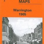 Warrington 1905
Openshaw 1905
Warrington 1905
Openshaw 1905
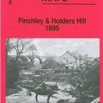 Finchley and Holders Hill 1895
West Twickenham & Strawberry Hill 1894 – 121a
Finchley and Holders Hill 1895
West Twickenham & Strawberry Hill 1894 – 121a
 West Twickenham & Strawberry Hill 1934 – 121b
Darlaston & King`s Hill 1901
West Twickenham & Strawberry Hill 1934 – 121b
Darlaston & King`s Hill 1901
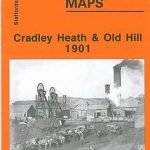 Cradley Heath and Old Hill 1901
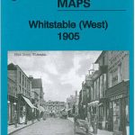 Whitstable West 1905
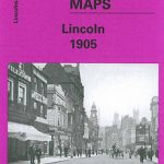 City of Lincoln 1905 – 70.07a
Huddersfield Central 1905
Horbury 1905
City of Lincoln 1905 – 70.07a
Huddersfield Central 1905
Horbury 1905
 Liverpool Toxteth 1906
 Oakenshaw, Low Moor and Wyke 1905
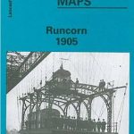 Runcorn 1905 – 115.13b
Gravelly Hill 1902
Runcorn 1905 – 115.13b
Gravelly Hill 1902
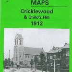 Cricklewood and Child`s Hill 1912
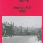 Muswell Hill 1935 – 11.4
 Muswell Hill 1913 – 11.3
 Coventry 1905 – 21.12b
Manchester North West and Central Salford 1915
Coventry 1905 – 21.12b
Manchester North West and Central Salford 1915
 Huddersfield South 1905
 Croydon 1895 – 157
Chigwell Row and Grange Hill 1914
Croydon 1895 – 157
Chigwell Row and Grange Hill 1914
 Liverpool Toxteth Mill Street 1847
 Warrington West 1905
 Knottingley 1905