Disclosure : This site contains affiliate links to products. We may receive a commission for purchases made through these links.
Lithuania Road Atlas
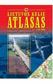
Handy A4 format road atlas with clear cartography. Detail includes minor and unpaved roads, railways and car ferries. Intermediate driving distances are marked on the map. Regional and district boundaries are drawn and different types of land use are distinguished eg. national parks, forest, open land, built-up areas, dumps.Symbols depict a wide range of features eg. customs posts, petrol stations, railway stations, architectural sites, ruins, various landmarks, motels, campsites. Latitude and longitude lines are drawn at 5` and 10` intervals respectively.Other features:Administrative map, distance table, gazetteer of sights of interest and tourist information.Comprehensive index of settlement names.Legend includes English.

Related Products:
 Lithuania Jana Seta Compact Road Atlas
 Lithuania Jana Seta Road Atlas HARDBACK
 Denmark K+F Road Map
 Ukraine Kartografija Road Atlas 500K HARDBACK
 Ukraine Road Atlas (500K, Spiral-bound)
 Lithuania & Kaliningrad Jana Seta Road Map
 Lithuania Jana Seta Road Map
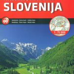 Slovenia Kartografija Road Atlas
Belarus Road Atlas
Poland: Carta Blanca/Kompas Road Atlas 2015 GLOVEBOX, SPIRAL-BOUND
Poland ExpressMap Road Atlas 2020/2021
Slovenia Kartografija Road Atlas
Belarus Road Atlas
Poland: Carta Blanca/Kompas Road Atlas 2015 GLOVEBOX, SPIRAL-BOUND
Poland ExpressMap Road Atlas 2020/2021
 Estonia Jana Seta Road Atlas
 Finland Road Atlas GLOVEBOX, SPIRAL-BOUND
Iceland Road Atlas 500K
Finland Road Atlas GLOVEBOX, SPIRAL-BOUND
Iceland Road Atlas 500K
 Lithuania: Alma Littera 100K Regional Maps
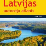 Latvia Jana Seta Compact Road Atlas
 Macedonia Road Map
 Crimea Road Atlas
 Alaska – Dempster and Dalton Highways ITMB Road Atlas
 Lithuania: Jana Seta 200K/250K Regional Touring Maps
 Argentina: ACA Zonal Road Maps
Finland Karttakeskus Road Atlas
Argentina: ACA Zonal Road Maps
Finland Karttakeskus Road Atlas
 Norway Hallwag Road Map
 Finland K+F Road Map
 Latvia Jana Seta Road Atlas
 Latvia: Jana Seta 100K Adventure Road Atlases
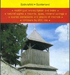 Secuimea Szekelyfold Cartographia Road Map
 Leningradskaya Oblast Road Atlas
 Baltic States Regio Road Atlas
 Norway Cappelens Road Atlas A4 SPIRAL-BOUND
 Hungary Pocket Road Atlas SPIRAL-BOUND
 Britain & Ireland Philip`s Big Road Atlas 2017
 Peloponnese Anavasi Road Atlas
 Denmark Hallwag Road Map
 Finland Hallwag Road Map
 Ukraine: Kartografija 500K Road Maps
 Lithuania: Briedis 50K Recreational Maps
 Hungary – Budapest Road Atlas SPIRAL-BOUND
 Poland ExpressMap Professional Users Road Atlas 2020/2021
 Britain & Ireland Philip`s Complete Road Atlas 2017 SPIRAL-BOUND