Disclosure : This site contains affiliate links to products. We may receive a commission for purchases made through these links.
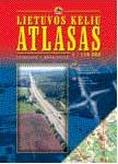
Lithuania & Kaliningrad Jana Seta Road Map

Lithuania and the Kaliningrad Oblast of Russia at 1:500,000 on an indexed road from the Riga based Jana Seta, with transit maps of Vilnius, Kaunas, Klaipeda, Panevezys, Siauliai and Kaliningrad, plus a distance table. The map presents road network in detail, distinguishing between paved, gravel and unsurfaced roads, showing locations of petrol stations, driving distances on most local roads, plus locations of border crossings. Railway lines, local airports and ferry routes are included. Picturesque towns and villages and other places of interest are highlighted. Also marked are the country’s internal administrative boundaries with names of the provinces. Topography is shown by spot heights for important hills and graphics or colouring for marches or swamps and woodlands. The map has latitude lines at 15’ intervals with longitude at 30’. The index is on the reverse. Map legend includes English.Enlargements, annotated with accommodation, petrol stations, tourist information offices, etc, show main streets and traffic arteries in Vilnius, Kaunas, Klaipeda, Panevezys, Siauliai and Kaliningrad. Also provided is a distance table.


