Disclosure : This site contains affiliate links to products. We may receive a commission for purchases made through these links.
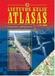
Lithuania Jana Seta Road Atlas HARDBACK

Road Atlas of Lithuania at 1:200,000 from the Riga-based Jana Seta in an A4 hardback format with indexed street plans of 57 towns, including enlargements for city centres of Vilnius, Kaunas and Klaipeda.The whole country is covered at 1:200,000, presenting detailed classification of the road network with petrol stations, and railway lines with stops. Boundaries of national parks and other protected areas are marked and a range of symbols indicate tourist accommodations, campsites, various places of interest, etc. Picturesque towns and villages are highlighted. Colouring and graphics show forested areas and swamps and the atlas also shows the country’s administrative divisions. Latitude lines are at intervals of 5’ intervals and longitude at 10’. Map legend includes English.Detailed street plans of 57 towns at 1:20,000 or 1:25,000 are annotated with places of interest and various facilities including hotels. Larger towns are shown on two or more pages. For Vilnius, Kaunas and Klaipeda more detailed plans shows the central area.Extensive 35-page index of place names is provided for the main section, with a separate street index for all the plans. Also included is road a map of the eastern Baltic Sea region, physical, administrative and route planning maps of Lithuania, general information for drivers and a distance table.

Related Products:
 Lithuania Jana Seta Compact Road Atlas
 Lithuania & Kaliningrad Jana Seta Road Map
 Latvia Jana Seta Compact Road Atlas
 Latvia Jana Seta Road Atlas
 Latvia Jana Seta Large Road Atlas HARDBACK
 Ukraine Kartografija Road Atlas 500K HARDBACK
 Lithuania Jana Seta Pocket Map
 Lithuania Jana Seta Road Map
 Baltic States Jana Seta Road Atlas
 Estonia Jana Seta Road Atlas
 Estonia Jana Seta Road Map
 Lithuania: Jana Seta 200K/250K Regional Touring Maps
 Belarus Jana Seta Road Map
 Kaunas Jana Seta Pocket Street Plan
 Lithuania Road Atlas
 Kaunas Jana Seta Street Plan WATERPROOF
 Latgale South Jana Seta Tourist Map
 Ukraine Road Atlas (500K, Spiral-bound)
Kurzeme North Jana Seta Tourist Map
Ukraine Road Atlas (500K, Spiral-bound)
Kurzeme North Jana Seta Tourist Map
 Kurzeme South Jana Seta Tourist Map
 Central Latvia Jana Seta Tourist Map
 Vidzeme North Jana Seta Tourist Map
New Zealand Kiwimaps Travellers Road Atlas
Vidzeme North Jana Seta Tourist Map
New Zealand Kiwimaps Travellers Road Atlas
 Kaunas Jana Seta Street Plan
Belarus Road Atlas
Kaunas Jana Seta Street Plan
Belarus Road Atlas
 Vidzeme East – Latgale North Jana Seta Tourist Map
 Lithuania – Vilnius Street Plan
 Lithuania
Iceland Road Atlas 500K
Lithuania
Iceland Road Atlas 500K
 India Road Atlas
Latvia 500K Jana Seta Map
India Road Atlas
Latvia 500K Jana Seta Map
 Sweden F&B Road Atlas
 Vilnius Jana Seta Street Plan WATERPROOF
 Manitoba & Saskatchewan MapArt Road Atlas
Mexico Road and Tourist Atlas
Manitoba & Saskatchewan MapArt Road Atlas
Mexico Road and Tourist Atlas
 Russia and the Neighbouring Countries Jana Seta Road Map
 Europe F&B Compact Road Atlas
 Latvia: Jana Seta 200K Regional Touring Maps
 Crimea Road Atlas
 Vilnius Jana Seta Street Plan