Disclosure : This site contains affiliate links to products. We may receive a commission for purchases made through these links.
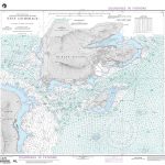
Lindau (Bodensee)

GPS compatible recreational maps of the Bavarian topographic survey at 1:25,000, with waymarked hiking trails and cycling routes, campsites and youth hostels, etc. Contours used in this map vary between 5 to 20m according to the terrain, with 20m interval predominantly used for hilly areas. Varied colouring show different types of landscape: woods, vineyards, fields etc. Maps in this series feature extensive overprint highlighting local and long-distance footpaths and cycle routes, including King Ludwig Way or different variants of the Way of St James, indicating their way marking. Symbols highlight different types of accommodation, sport and recreational facilities, various places of interest, etc. The maps have a 1-km UTM grid. Map legend and text in German only.

Related Products:
 Lindau – Nature Park Nagelfluhkette UK50-45
 Lindau – Naturpark Nagelfluhkette
 Thannhausen
 Sonthofen
Oberstdorf
Krumbach (Schwaben)
Kempten (Allgรคu)
Sonthofen
Oberstdorf
Krumbach (Schwaben)
Kempten (Allgรคu)
 Bad Kissingen
 Mering
Ammersee
Mering
Ammersee
 Nรถrdlingen
 Lauingen
 Illertissen
 Memmingen
Bad Grรถnenbach
Memmingen
Bad Grรถnenbach
 Lindenberg
 Weitnau
Scheidegg
Weitnau
Scheidegg
 Bissingen
Hassfurt
Bissingen
Hassfurt
 Reisbach
Pappenheim J09
Aschaffenburg D01
Karlstadt D04
Schongau P08
Arnstein D05
Alzenau C01
Schollkrippen C02
Reisbach
Pappenheim J09
Aschaffenburg D01
Karlstadt D04
Schongau P08
Arnstein D05
Alzenau C01
Schollkrippen C02
 Schillingsfรผrst
 Dinkelsbรผhl
Weilheim in Oberbayern
Dinkelsbรผhl
Weilheim in Oberbayern
 Altmuhltal NP West UK50-23
Landsberg am Lech O08
Altmuhltal NP West UK50-23
Landsberg am Lech O08
 Hof
Bad Windsheim – Rothenburg ob der Tauber G06
Pottmes L09
Aichach M09
Ansbach H07
Markt Erlbach G07
Hof
Bad Windsheim – Rothenburg ob der Tauber G06
Pottmes L09
Aichach M09
Ansbach H07
Markt Erlbach G07
 Velburg H12