Disclosure : This site contains affiliate links to products. We may receive a commission for purchases made through these links.
Lima METRO Street Plan
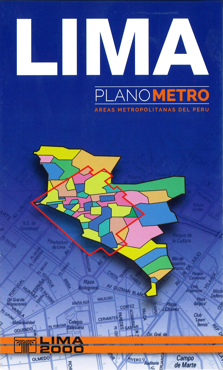
Comprehensive, indexed street map of greater Lima, including its outer parts. Colours distinguish the city’s districts, and estate sub-divisions (urbanizaciones) are identified, with block numbers marked along the streets. Some of the outermost parts of the city are shown as insets. Subtle hill-shading with contours depicts the relief and parks, wetland and agricultural areas are indicated. Small symbols show police stations, churches, markets, colleges, hospitals, post offices, etc. A large area is represented on this map, so street names and block numbers are in very small print, difficult to read without a magnifying glass. On the reverse the index lists streets, districts and selected places of interest, e.g. hospitals, churches, museums.

Related Products:
 Arequipa Metro Plan
 Cusco Metro Plan
 Innsbruck F&B Tourist Street Plan
 Riga City Center Jana Seta Street Plan
 Lagos
Lagos
 Trujillo Metro Plan
 Cornwall Philip`s Street Atlas
 Jurmala Jana Seta Street Plan
 Kaliningrad Street Plan
 Dorset Philip`s Street Atlas
 Riga and Vicinity Jana Seta Street Atlas
 Wiltshire and Swindon Philip`s Street Atlas
 Gloucestershire Philip`s Street Atlas
 Surrey Philip`s Street Atlas
 Plymouth A-Z Street Plan Wall Map
 Vilnius Jana Seta Pocket Street Plan
 Norfolk Philip`s Street Atlas
 Devon Philip`s Street Atlas
 Leeds A-Z Street Plan Wall Map
 Lisbon Michelin City Plan and Index
 Moscow Jana Seta Street Plan
 Salzburg F&B Street Plan
 London Philip`s Mini Street Atlas
 Exeter A-Z Pocket Street Map
 Lisburn City OSNI Street Plan
 Dakar Laure Kane Street Plan
 Bishkek Street Plan
 Derbyshire Philip`s Street Atlas
 Liverpool A-Z Street Plan Wall Map
 Szczecin – Swinoujscie – Police ExpressMap Street Plan
 Abuja
Abuja
 Armagh City OSNI Street Plan
 Lodz ExpressMap Street Plan
 Budapest Street Atlas
 Oxford A-Z Pocket Street Map
 Leicester A-Z Street Plan Wall Map
 Kaunas Jana Seta Street Plan WATERPROOF
 Vienna F&B Tourist Street Plan
 Christchurch Visitors` Street Plan
 Cusco City and Region Traveler`s Map