Disclosure : This site contains affiliate links to products. We may receive a commission for purchases made through these links.
Leyton 1914
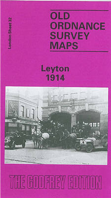
Leyton in 1914 in a fascinating series of reproductions of old Ordnance Survey plans in the Alan Godfrey Editions, ideal for anyone interested in the history of their neighbourhood or family. Three versions cover the same area, from Templemill Sidings eastward to Woodhouse Road and Newcomen Road, and from Carlisle Road and St Mary`s church southward to Crownfield Road. St Patricks RC cemetery is in the centre of the map and other features include the massive West Ham Union Workhouse opened in 1840, GER wagonworks, Leyton Isolation Hospital, Ruckholt Farm, tramways and tram works, GER Epping line with Leyton station, Tottenham & Forest Gate line with Leytonstone station, Harrow Green, Holy Trinity church. The principal roads running north-south through the map are Leyton Road and High Road. Leyton itself is to the top of the map, while in the south-eastern corner is Wanstead Slip, with Jews Cemetery. The first map shows an almost entirely rural village, with development only just begun and Leyton station standing among fields; by 1914 the area was largely built on. The population of Leyton in 1861 was just 4,794; by 1921 it had risen to 128,430. About the Alan Godfrey Editions of the 25″ OS Series:Selected towns in Great Britain and Ireland are covered by maps showing the extent of urban development in the last decades of the 19th and early 20th century. The plans have been taken from the Ordnance Survey mapping and reprinted at about 15 inches to one mile (1:4,340). On the reverse most maps have historical notes and many also include extracts from contemporary directories. Most maps cover about one mile (1.6kms) north/south, one and a half miles (2.4kms) across; adjoining sheets can be combined to provide wider coverage.FOR MORE INFORMATION AND A COMPLETE LIST OF ALL AVAILABLE TITLES PLEASE CLICK ON THE SERIES LINK.

Related Products:
 Leyton 1863-1867
 Leytonstone & Leyton 1915 – 23.3
 Brockley & Honor Oak 1914 – 118.3
 Stepney & Limehouse 1914 – 64.3
 Newcastle & Gateshead 1914 – 18b
 Stoke Newington 1914 – 30.3
 Lewisham 1914 – 119.3
Chigwell Row and Grange Hill 1914
Lewisham 1914 – 119.3
Chigwell Row and Grange Hill 1914
 Bermondsey & Wapping 1914 – 77.3
Paddington 1914 – 60.3
Pwllheli 1914
Bermondsey & Wapping 1914 – 77.3
Paddington 1914 – 60.3
Pwllheli 1914
 Poplar 1914 – 65.3
Llantwit Major 1914
Streatham Hill & Tulse Hill 1914 – 126.3
Poplar 1914 – 65.3
Llantwit Major 1914
Streatham Hill & Tulse Hill 1914 – 126.3
 Hartlepool 1914 – 37.07c
 Shoreditch 1914 – 51.3
Chigwell Station 1914
West Hartlepool 1914 – 37.11c
Stourbridge South and Oldswinford 1914
Jesmond 1914
Shoreditch 1914 – 51.3
Chigwell Station 1914
West Hartlepool 1914 – 37.11c
Stourbridge South and Oldswinford 1914
Jesmond 1914
 East Dulwich & Peckham Rye 1914 – 117.3
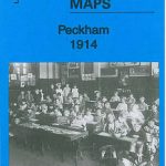 Peckham 1914 – 103.3
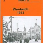 Woolwich 1914
Trimdon Grange 1914
Woolwich 1914
Trimdon Grange 1914
 Bethnal Green & Bow 1914 – 52.3
 Clapham Common 1914 – 115.3
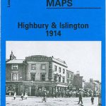 Highbury & Islington 1914 – 39.3
 Stratford 1914 – 42.3
The West End 1914 – 61.3
Stratford 1914 – 42.3
The West End 1914 – 61.3
 Chesterfield 1914 – 25.06b
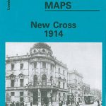 New Cross 1914 – 104.3
Wolverhampton Bushbury 1914
New Cross 1914 – 104.3
Wolverhampton Bushbury 1914
 Silvertown 1914
 Canning Town & Custom House 1914 – 66.3
 Blackheath 1914 – 105.3
Gurnos 1914 – 43.14
Kensington 1914 – 74.3
Willesden and Stonebridge Park 1936
Birmingham West 1914
Blackheath 1914 – 105.3
Gurnos 1914 – 43.14
Kensington 1914 – 74.3
Willesden and Stonebridge Park 1936
Birmingham West 1914
 Old Kent Road 1914 – 90.3