Disclosure : This site contains affiliate links to products. We may receive a commission for purchases made through these links.
Lesser Antilles: Guadeloupe and Martinique
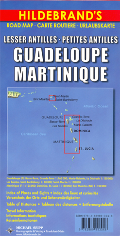
Indexed maps at various scales portraying Martinique, Dominica, St. Lucia, St. Martin, St Barthรฉlemy and Guadeloupe (La Dรฉsirade, Les Saintes and Marie-Galante in insets). The most striking characteristic is the vivid representation of the general relief, using hill-shading. Some peak heights are marked and national parks, and reefs are shown. Road detail includes some secondary roads and tracks, and shows intermediate distances on major routes, with scenic routes highlighted. Airports and ferry links are also marked. Symbols show various features, landmarks and recreation sites eg. places of interest, viewpoints, churches, lighthouses, ruins, beaches, campsites, golf courses and watersport locations. Latitude and longitude lines are drawn at 10’ intervals.Map scales:Guadeloupe, Basse-Terre & Grand-Terre 1:165,000Marie-Galante & La Dรฉsirade 1:130,000Les Saintes & St Barthรฉlemy 1:60,000St. Martin 1:100,000Martinique 1:125,000Dominica & St. Lucia 1:180,000Also included is a 1:7,000,000 general map of the Caribbean region. On the reverse are notes on the selected islands’ history, geography and attractions. Notes and legend are in French, German and English.

Related Products:
 Martinique & Guadeloupe ITMB
 Guadeloupe – Basse Terre – La Soufriรจre – Les Saintes – PN de la Guadeloupe IGN 4605GT
 Guadeloupe – Basse-Terre North – Les Mamelles – PN de la Guadeloupe IGN 4602GT
 Guadeloupe – Saint-Franรงois – Marie-Galante – La Dรฉsirade IGN 4604GT
 Guadeloupe/French Antilles: 25K Topographic Survey Maps
 La Guadeloupe et ses รฎles ร pied
 SHOM Chart 6948L – Guadeloupe – De Pointe-ร -Pitre ร Marie-Galante – Canal des Saintes – Leisure A4 size
 Insight Guides Caribbean: The Lesser Antilles (Travel Guide with Free eBook)
Guadeloupe & Dominica ITMB
Insight Guides Caribbean: The Lesser Antilles (Travel Guide with Free eBook)
Guadeloupe & Dominica ITMB
 Caribbean – Lesser Antilles Nelles
 SHOM Chart 6948 – Guadeloupe – De Pointe-ร -Pitre ร Marie-Galante – Canal des Saintes
 Guadeloupe – St. Martin – St. Barthรฉlemy Michelin Zoom 137
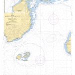
 Admiralty Chart 618 – Southern Guadeloupe including Marie-Galante and Les Saintes
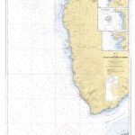
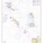
 Admiralty Chart 1042 – West Indies – Montserrat to St. Lucia, Lesser Antilles
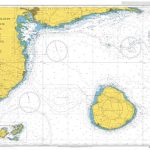
 Admiralty Chart 594 – Southern Guadeloupe to Northern Martinique
 SHOM Chart 7345L – Guadeloupe – De Montserrat ร Marie-Galante – Leisure A4 size
 SHOM Chart 7482L – Guadeloupe – De l’รฎlet ร Kahouanne aux Saintes – Leisure A4 size
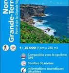 Guadeloupe – Grande-Terre North – Pointe de la Grande Vigie IGN 4601GT
 Guadeloupe – St. Martin / Sint Maarten – St. Barthelemy IGN 84971
 Guadeloupe – Pointe-ร -Pitre – Sainte-Anne IGN 4603GT
 A28 Guadeloupe
 SHOM Chart 7482 – Guadeloupe – De l’รฎlet ร Kahouanne aux Saintes
 SHOM Chart 7102L – Ports et mouillages de Grande-Terre, de Marie Galante et de la Dรฉsirade – Leisure A4 size
A Cruising Guide to the Lesser Antilles
SHOM Chart 7102L – Ports et mouillages de Grande-Terre, de Marie Galante et de la Dรฉsirade – Leisure A4 size
A Cruising Guide to the Lesser Antilles
 Reg 12.2 Leeward Islands
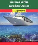 Caribbean Cruises F&B
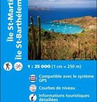 Saint-Martin / Sint Maarten – St.Barthรฉlemy IGN 4606GT
 Saint Lucia & Martinique ITMB
 SHOM Chart 7100 – Guadeloupe – Abords de Pointe-ร -Pitre
Admiralty Chart Folio 87 – Guadeloupe to Trinidad, Venezuela and Guyana
SHOM Chart 7100 – Guadeloupe – Abords de Pointe-ร -Pitre
Admiralty Chart Folio 87 – Guadeloupe to Trinidad, Venezuela and Guyana
 Admiralty Chart 804 – Guadeloupe Pointe-a-Pitre and Approaches
 SHOM Chart 7630L – De Anguilla ร La Guadeloupe – Leisure A4 size
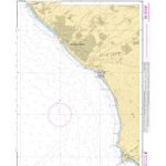 SHOM Chart 3127 – Abords de Basse-Terre – De la riviรจre des Pรจres ร la Pointe du Vieux Fort
 Leeward Island Anchorages
 Martinique – Fort-de-France – Montagne Pelee – PNR de la Martinique IGN 4501MT
 SHOM Chart 7102 – Ports et mouillages de Grande-Terre, de Marie Galante et de la Dรฉsirade
 SHOM Chart 7100L – Guadeloupe – Abords de Pointe-ร -Pitre – Leisure A4 size
 Guadeloupe Flag – 1/2 yard – Printed
 Caribbean Islands East & South ITMB Travel Atlas
 SHOM Chart 7208L – De Marie-Galante ร la Dรฉsirade – Leisure A4 size