Disclosure : This site contains affiliate links to products. We may receive a commission for purchases made through these links.
Latvia 500K Jana Seta Map
Latvia at 1:500,000 on a map from the country`s leading cartographic publisher Jana Seta, with plans showing access routes and main streets in Riga, Daugavpils, Jelgava, Liepaja, Rezekne Ventaspils and Valmiera. The map shows the country’s road network, including selected gravel roads and country tracks, indicating locations of petrol stations and border crossings, with driving distances on main and most secondary routes. Railway lines are shown with main stations. Picturesque towns or villages, national parks or protected areas and other places of particular interest are highlighted and locations of campsites are marked. The map also shows internal administrative boundaries with names of the provinces. Latitude and longitude lines are drawn at 30’ intervals. Map legend includes English.On the reverse is an index and maps of Riga, Daugavpils, Jelgava, Liepaja, Rezekne Ventaspils and Valmiera showing access routes and main streets. Also included is a distance table.

Related Products:
 Latvia Jana Seta Pocket Map
 Latvia 700K Jana Seta Map
 Central Latvia Jana Seta Tourist Map
 Latvia Jana Seta Road Atlas
 Latvia Jana Seta Compact Road Atlas
 Latvia: Jana Seta 75K Maps of Environs of Main Towns
 Latgale South Jana Seta Tourist Map
 Riga and Vicinity Jana Seta Street Atlas
 Vidzeme East – Latgale North Jana Seta Tourist Map
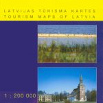 Latvia: Jana Seta 200K Regional Touring Maps
 Riga and its Vicinity Jana Seta Map
 Valmieras and its Vicinity Jana Seta Map
 Latvia: Jana Seta 100K Adventure Road Atlases
 Vidzeme North Jana Seta Tourist Map
 Riga City Center Jana Seta Street Plan
 Belarus Jana Seta Road Map
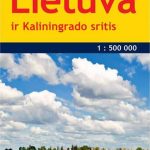 Lithuania & Kaliningrad Jana Seta Road Map
 Kurzeme North Jana Seta Tourist Map
 Kurzeme South Jana Seta Tourist Map
 Estonia Jana Seta Road Atlas
 Jurmala Jana Seta Street Plan
 Latvia F&B 2-Map Set
 Lithuania Jana Seta Road Map
 Estonia Jana Seta Road Map
 Lithuania Jana Seta Compact Road Atlas
 Lithuania Jana Seta Road Atlas HARDBACK
 St. Petersburg Jana Seta Street Plan
 Saldus and its Vicinity Jana Seta Map
 Kuldiga and its Vicinity Jana Seta Map
 Ventspils and its Vicinity Jana Seta Map
 Latvia Reise-Know-How
 Vilnius Jana Seta Street Plan WATERPROOF
 Talsi – Dundaga – Roja Districts Jana Seta Map
 Lithuania: Jana Seta 200K/250K Regional Touring Maps
 Latvia Jana Seta Cycling Routes Map
 Latvia Jana Seta Large Road Atlas HARDBACK
 Kaunas Jana Seta Street Plan WATERPROOF
 Old Riga Jana Seta Tourist Street Plan
 Kaunas Jana Seta Street Plan
 Moscow Jana Seta Street Plan