Disclosure : This site contains affiliate links to products. We may receive a commission for purchases made through these links.
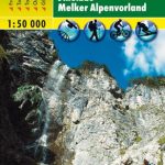
Lattengebirge – Reiteralm Alpenverein KOMBI BY20
Lattengebirge – Reiteralm, map No. BY 20, in a series of highly detailed, GPS compatible hiking maps at 1:25,000 of the German Alps, published by the Deutscher Alpenverein, the German Alpine Club, with cartography of the German topographic survey from the Bavarian state survey organization. The maps use the survey’s excellent detailed cartography with contours at 20m intervals, shading and graphic relief for exposed rocky areas. Different types of vegetation and land use are shown. The overprint highlights waymarked hiking paths, including long-distance routes, indicating their numbers or names, as well as climbing and ski routes. Symbols show locations of youth hostels, campsites, mountain huts and shelters, and various places of interest. The maps have a 1km UTM grid. Map legend and the information on the reverse with advice for hikers are in German only.To see the other titles in this series please click on the series link.

Related Products:
 Wettersteingebirge – Zugspitze Alpenverein KOMBI BY8
 Berchtesgaden – Untersberg Alpenverein KOMBI BY22
Berchtesgaden National Park – Watzmann Alpenverein KOMBI BY21
Chiemgau Alps East – Sonntagshorn Alpenverein KOMBI BY19
Berchtesgaden – Untersberg Alpenverein KOMBI BY22
Berchtesgaden National Park – Watzmann Alpenverein KOMBI BY21
Chiemgau Alps East – Sonntagshorn Alpenverein KOMBI BY19
 Allgรคu Prealps West – Nagelfluhkette – Hรถrnergruppe Alpenverein KOMBI BY1
Chiemgau Alps Central – Hochgern – Hochfelln Alpenverein KOMBI BY18
Mangfallgebirge East – Wendelstein – Grosser Traithen Alpenverein KOMBI BY16
Germany: Alpenverein/Bavarian Survey 25K Hiking Maps
Isarwinkel – Benediktenwand Alpenverein BY11
Karwendelgebirge North – Schafreiter Alpenverein BY12
Allgรคu Prealps West – Nagelfluhkette – Hรถrnergruppe Alpenverein KOMBI BY1
Chiemgau Alps Central – Hochgern – Hochfelln Alpenverein KOMBI BY18
Mangfallgebirge East – Wendelstein – Grosser Traithen Alpenverein KOMBI BY16
Germany: Alpenverein/Bavarian Survey 25K Hiking Maps
Isarwinkel – Benediktenwand Alpenverein BY11
Karwendelgebirge North – Schafreiter Alpenverein BY12
 Kleinwalsertal – Hoher Ifen – Widderstein Alpenverein Map BY2
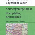 Ammergebirge West – Hochplatte – Kreuzspitze Alpenverein BY6
 Mangfallgebirge Central – Spitzingsee – Rotwand Alpenverein BY15
 Mangfallgebirge West – Tegernsee – Hirschberg Alpenverein BY13
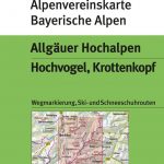 Allgรคuer Hochalpen – Hochvogel – Krottenkopf Alpenverein BY4
Mangfallgebirge South – Guffert – Unnรผtz – Juifen Alpenverein BY14
Allgรคuer Hochalpen – Hochvogel – Krottenkopf Alpenverein BY4
Mangfallgebirge South – Guffert – Unnรผtz – Juifen Alpenverein BY14
 Allgรคuer Voralpen Ost – Grรผnten – Wertacher Hรถrnle Alpenverein BY3
Chiemgau Alps West – Hochries – Geigelstein Alpenverein Komi Map BY17
Allgรคuer Voralpen Ost – Grรผnten – Wertacher Hรถrnle Alpenverein BY3
Chiemgau Alps West – Hochries – Geigelstein Alpenverein Komi Map BY17
 Dachsteingruppe Alpenverein KOMBI Map 14
 Venedigergruppe Alpenverein KOMBI Map 36
 Granatspitzgruppe Alpenverein KOMBI Map 39
 Hochschwabgruppe Alpenverein KOMBI Map 18
 Kaisergebirge Alpenverein KOMBI Map 8
 Glocknergruppe Alpenverein KOMBI Map 40
 Silvretta Alpenverein KOMBI Map 26
 Sonnblick Alpenverein KOMBI Map 42
 Schobergruppe Alpenverein KOMBI Map 41
 Hochkรถnig – Hagengebirge Alpenverein KOMBI Map 10/2
 Stubai Alps – Hochstubai Alpenverein KOMBI Map 31/1
 Otztal Alps – Gurgl Alpenverein KOMBI Map 30/1
 Otztal Alps – Kaunergrat Alpenverein KOMBI Map 30/3
 Langkofel – Sellagruppe Alpenverein KOMBI Map 52/1
Steinernes Meer Alpenverein KOMBI Map 10/1
Langkofel – Sellagruppe Alpenverein KOMBI Map 52/1
Steinernes Meer Alpenverein KOMBI Map 10/1
 Totes Gebirge Central Alpenverein KOMBI Map 15/2
 Zillertal Alps East Alpenverein KOMBI Map 35/3
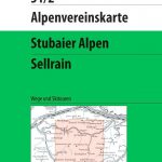 Stubai Alps – Sellrain Alpenverein KOMBI Map 31/2
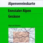 Ennstal Alps – Gesause Alpenverein KOMBI Map 16
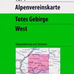 Totes Gebirge West Alpenverein KOMBI Map 15/1
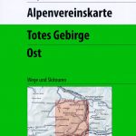 Totes Gebirge East Alpenverein KOMBI Map 15/3
 Otztal Alps – Weisskugel Alpenverein KOMBI Map 30/2