Disclosure : This site contains affiliate links to products. We may receive a commission for purchases made through these links.
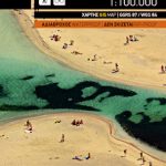
Lasithi – Eastern Crete Anavasi 92
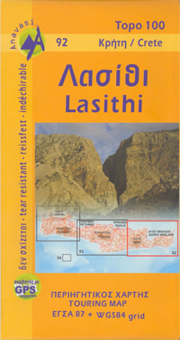
Eastern Crete: Lasithi from Anavasi in a series of three GPS compatible road maps with topographic base, printed on waterproof and tear-resistant paper. Contours at 100m intervals, relief shading and spot heights show the island’s topography, and the maps also indicate variations in vegetation: forest, shrubbery, orchards, and vineyards. Road network includes minor unsurfaced roads and dirt tracks, and indicates difficult or at times impassible roads, locations of petrol stations and tyre repair workshops, as well as intermediate distances between selected points.Archaeological or historical sites and other places of interest are highlighted, with symbols marking beaches, campsites, caves, museums, monasteries, etc. Names of town, villages, places of interest, and most geographical features are in both Greek and Latin script. The maps have both Greek coordinate system grid lines and ticks for latitude and longitude lines at 5’ intervals. The index on the reverse of the maps is in both scripts. Map legend includes English.*In this title:* the eastern part of the island, from approximately 15 km east of Iraklion, including the Lasithi Mountains, Malia, Aghia Nikolaos and Sitia.


