Disclosure : This site contains affiliate links to products. We may receive a commission for purchases made through these links.
Categories
-
Best Sellers
-
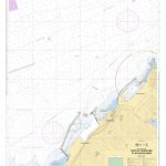
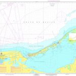
SHOM Chart 7707 – Ports de Tanger Med et de Ksar-es-Srhir
PLEASE NOTE: the chart will be ordered for you if not currently in stock. Please allow 1-2 weeks for the chart to reach Stanfords. SHOM charts Read More » -

s-Hertogenbosch (Den Bosch) East
Kadaster, Holland`s national survey organization, produces one of the most attractive topographic surveys in Europe. The maps are very colourful, with their characteristic patchwork of polders Read More » -

Wimpy Kid Fregley: Backpack Notes
The Wimpy Kid Fregley Backpack Notes from Mudpuppy are the perfect way to take one of your favorite Wimpy Kid characters on the road and share Read More » -

Mammon in Malmo
With a new Skane County Police commissioner wanting to make his mark in Malmoe, the Criminal Investigation Squad is under pressure when they are called in Read More » -

The Nursery Alice
โ€I wrote to Macmillan to suggest a new idea: a `Nursery Edition` of Alice with pictures printed in.โ€ Lewis Carroll`s diary, 15th February, 1881 The Nursery Read More » -

We`re Going on a Bear Hunt: Christmas Activity Book
Featuring artwork from the animated special, this fun-filled guide to all things Christmas is packed with craft activities, recipes and stickers galore. Whether making a festive Read More » -

Germany South High 5 Edition Camping Map
The first water-resistant roadmap with direct access to useful additional information from the InternetSouthern Germany in a scale of 1:550,000 shown on a practical map; inclusive Read More » -

Stafford, Telford & Ironbridge OS Landranger Map 127 (paper)
Paper version of map No. 127 from the Ordnance Survey’s Landranger series at 1:50,000, with contoured and GPS compatible topographic mapping plus tourist information.MOBILE DOWNLOADS: As Read More » -
Calzada de los Molinos CNIG Topo 235-2
-

NOAA Chart 16683 – Point Elrington to Cape Resurrection
NOAA maintains the nautical charts and publications for U.S. coasts and the Great Lakes. Over a thousand charts cover 95,000 miles of shoreline and 3.4 million Read More »
-


