Disclosure : This site contains affiliate links to products. We may receive a commission for purchases made through these links.
Larochette – Lorentzweiler

Larochette – Lorentzweiler area of Luxembourg in the country’s detailed topographic survey at 1:20,000 from the Administration du Cadastre et de la Topographie. The maps in this series have contours at 5-metres intervals enhanced by additional hill shading. An overprint highlights long-distance footpaths, cycle tracks, and various places of interest, e.g. tourist information offices, campsites, hostels, climbing sites, golf courses, etc. The maps have a UTM grid and the legend includes English.

Related Products:
 Luxembourg: 20K Topographic Tourist Maps
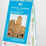 Clervaux – Huldange
 Boulaide – Wiltz
 Diekirch – Putscheid
 Steinfort – Redange
 Wasserbillig – Beaufort
 Sandweiler – Grevenmacher
 Dudelange – Clemency
 Schengen – Weiler-la-Tour
 Luxembourg City and the Surrounding Area
 Donegal SW OSI Discovery 10
 Cork OSI Discovery 86
 Wexford OSI Discovery 69
 Galway W OSI Discovery 44
 Kerry OSI Discovery 78
 Waterford SE OSI Discovery 82
Clare OSI Discovery 57
Cork S OSI Discovery 87
Kerry OSI Discovery 83
Waterford SE OSI Discovery 82
Clare OSI Discovery 57
Cork S OSI Discovery 87
Kerry OSI Discovery 83
 Mayo OSI Discovery 23
 Donegal NE OSI Discovery 3
 Donegal N OSI Discovery 2
Cork Central OSI Discovery 80
Donegal NW OSI Discovery 1
Donegal N OSI Discovery 2
Cork Central OSI Discovery 80
Donegal NW OSI Discovery 1
 Cork – Kerry OSI Discovery 85
Donegal – Tyrone OSI Discovery 6
Cork – Kerry OSI Discovery 85
Donegal – Tyrone OSI Discovery 6
 Kerry (Dingle) OSI Discovery 70
 Clare – Galway OSI Discovery 51
 Mayo NW OSI Discovery 22
 Cork SW OSI Discovery 88
Kilkenny – Tipperary – Waterford OSI Discovery 75
Cork SW OSI Discovery 88
Kilkenny – Tipperary – Waterford OSI Discovery 75
 Mayo Central OSI Discovery 31
 Donegal – Fermanagh – Tyrone OSI Discovery 11
Laois – Offaly – Tipperary OSI Discovery 54
Donegal – Fermanagh – Tyrone OSI Discovery 11
Laois – Offaly – Tipperary OSI Discovery 54
 Sligo – Leitrim – Roscommon OSI Discovery 25
 Mayo West-Central OSI Discovery 30
Clare – Limerick – Tipperary OSI Discovery 65
Mayo West-Central OSI Discovery 30
Clare – Limerick – Tipperary OSI Discovery 65
 Armagh – Down – Louth – Meath – Monaghan OSI Discovery 36
Galway – Longford – Roscommon – Westmeath OSI Discovery 40
Armagh – Down – Louth – Meath – Monaghan OSI Discovery 36
Galway – Longford – Roscommon – Westmeath OSI Discovery 40
 Kerry OSI Discovery 78 WATERPROOF