Disclosure : This site contains affiliate links to products. We may receive a commission for purchases made through these links.
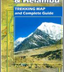
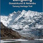
Langtang and Helambu Trekking Map

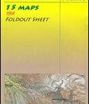
The Langtang and Helambu trekking region on a map at 1:100,000 from the Kolkata/Calcutta based Milestone Books, highlighting main trekking routes and showing peaks, passes and selected locations with altitude both in metres and feet. Coverage extends from Kathmandu and Nagarkot to Kyirong in Tibet and across the peaks from the Ganesh Himal range in the west to Mt. Shisha Pangma in Tibet and the Jugal Himal range in Nepal.The map has contour lines at 400m intervals superimposed on a base derived from satellite imagery, although (as the publisher’s note mentions) the colouring and the shading may not necessarily coincide with the contour lines. Heights for peaks, passes and selected settlements are given both in metres and in feet. The marking for trekking routes distinguishes between main trails and other treks. Symbols indicate locations with tourist accommodation. The map has no geographical coordinates.PLEASE NOTE: the same map is also available as part of the Lantang and Helambu Trekking Guide.


