Disclosure : This site contains affiliate links to products. We may receive a commission for purchases made through these links.
Langsua Nordeca 3002

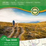
Topo 3000 Lansua by Nordeca AS is a detailed map covering over 3000km2 of the area between Beitostรธlen, Espedalen and Spรฅtind. Easy to find hiking routes and lodgings in the area. The map covers all of Langsua national park and is perfect for hiking from cabin to cabin in Huldrehiemen, going to the top of Skaget or taking a day hike to the east on Valdresfly.

Related Products:
 Hallingskarvet NP Nordeca 3001
 Dovrefjell East Nordeca 3020
 Jostedalsbreen NP Nordeca 3009
 Haukelifjell Nordeca 3004
 Breheimen Nordeca 3011
 Stolsheimen Nordeca 3012
 Filefjell Nordeca 3013
 Lysefjorden Nordeca 3003
 Folgefonna Nordeca 3005
 Hardangervidda Nordeca 3006
 Tromsรธ-Kvalรธya Nordeca 3010
 Voss-Bergsdalen Nordeca 3007
 Vassfaret – Norefjell Nordeca 3014
 Alvdal Vestfjell Nordeca 3015
 Lillehammer-Rena Nordeca 3008
 Hemsedal Nordeca 3022
 Hedmarksvidda Nordeca 3027
Senja South Nordeca 3028
Senja North Nordeca 3029
Hedmarksvidda Nordeca 3027
Senja South Nordeca 3028
Senja North Nordeca 3029
 South Valdres Nordeca 3021
 Indre Etnefjell Nordeca 3023
 Sylan South Nordeca 3024
 Sylan North Nordeca 3025
 Lyngen Peninsula Nordeca 3026
 Skรฅbu – Espedalen – Fefor Nordeca 2561
 Khumbu NGS Adventure Map 3002
 Espedalen Nordeca 10057
 Bergen – 7-Mountains Hike Nordeca 2429
Norway: Nordeca Topo 3000
Bergen – 7-Mountains Hike Nordeca 2429
Norway: Nordeca Topo 3000
 Folgefonna National Park Nordeca 2663
 South Downs National Park and East Sussex
 Dilijan National Park Cartisan Hiking Map
 Broads National Park Pocket Map
 South Downs National Park Pocket Map
 Waterton Lakes National Park Gem Trek Map
 South Downs Park Rangers Favourite Walks
 Grasslands National Park: East Block, Saskatchewan
 Domodossola – Val Grande National Park Swisstopo Hiking 285T
 Bardu Nordeca 2599
 Triglav National Park Kartografija WATERPROOF Hiking Map