Disclosure : This site contains affiliate links to products. We may receive a commission for purchases made through these links.
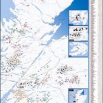
Lake District – Wainwright Fells & Tick List GuideUs Wall Map SMALL
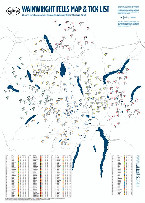
The Wainwright Fells with a Tick List Wall Map from GuideUs, in a smaller size A2 poster version (42×59.5cm / 16.5″x23.5″ approx), showing the Wainwright Fells divided into seven areas according to the classic series of guides by Alfred Wainwright: Eastern, Far Eastern, Central, Southern, Northern, North Western and Western Fells. Each area is clearly defined by a different colour and all hills are numbered and cross-referenced to a list of the 214 peaks.This smaller version of the poster shows the Lake District at 1:110,000, with names of hills, valleys, passes, lakes, major towns and main roads. Coverage extends from the Northern Fell group north of Keswick to the fells around Coniston. Below the map is a table listing all the 214 hills with their altitudes in metres and feet, as well as Wainwright’s original values and their corresponding Wainwright guidebook area. The table also has clear colour-coding showing the area each hill belongs to and a box to tick off each Wainwright fell as it is completed. The poster is printed on high quality 170gsm paper.PLEASE NOTE: this smaller version is also available as a folded map, plus as a poster published in a larger A1 size version at 1:75,000. GuideUs also publish a chart showing the Wainwright Outlying Fells of the Lake District.

Related Products:
 Lake District – Wainwright Fells & Tick List GuideUs Wall Map LARGE
 Wainwright Outlying Fells GuideUs Wall Map with a Tick List
 The Wainwright Fells of the Lake District
 214 Wainwright Fells and the tarns of the Lake District Wall Map
 Topographical Map of the Lake District – Wainwright Fells
 Peak Bagging: Wainwrights: 45 routes designed to complete all 214 of Wainwright`s Lake District fells in the most efficient way
 North Western Fells – Book 6 (Revised Edition)
 Lake District – Low Fells
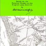
 Wainwright`s Guides to the Lakeland Fells and Other Locations
 Far Eastern Fells – Book 2 (Revised Edition)
 Western Fells – Book 7 (Revised Edition)
 Walking the Lake District Fells – Coniston: Coniston Fells, Duddon Valley and Eskdale
 Munro Map GuideUs Wall Map with Tick List
 Walking the Lake District Fells – Borrowdale: Scafell Pike, Catbells, Great Gable and the Derwentwater Fells
 Eastern Fells – Book 1 (Revised Edition)
 Lake District – High Fells
 Far Eastern Fells – Book 2 (Readers Edition)
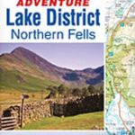 Lake District – Northern Fells Adventure Atlas
 North Western Fells – Book 6 (Readers Edition)
 Walking the Lake District Fells – Keswick: Skiddaw, Blencathra and the North
 Wainwright Map 6 – North Western Fells
 Lake District Great Mountain Days: 50 Classic Routes for Exploring the Lakeland Fells
 Northern Fells – Book 5 (Revised Edition)
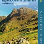 Walking the Lake District Fells – Buttermere: High Stile, Grasmoor, Grisedale Pike and Haystacks
 Central Fells – Book 3 (Revised Edition)
 Wainwright Map 1 – Eastern Fells
 Walking the Lake District Fells – Patterdale: Helvellyn, Fairfield and the East
 Walking the Lake District Fells – Mardale and the Far East: High Street and Kentmere
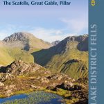 Walking the Lake District Fells – Wasdale: The Scafells, Great Gable, Pillar
 Walking the Lake District Fells – Langdale: The Langdale Pikes and Bowfell
 Wainwright Maps (2): The Far Eastern Fells
 Wainwright Map 7 Western Fells
 Wainwright Maps (5): The Northern Fells
 Lake District Climbs and Scrambles: Mountaineering Days Out on the Lakeland Fells
 Southern Fells – Book 4 (Revised Edition)
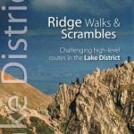 Lake District Ridge Walks & Scrambles: Challenging high-level routes in the Lake District
 Eastern Fells – Book 1 (Readers Edition)
 Walking the Tour of the Lake District: A nine-day circuit of Cumbria`s fells, valleys and lakes
 Lake District: Low Level and Lake Walks
 Lake District: High Level and Fell Walks: 30 Best Fell Walks