Disclosure : This site contains affiliate links to products. We may receive a commission for purchases made through these links.
Categories
-
Best Sellers
-

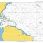
Admiralty Chart 4012 – North Atlantic Ocean Southern Part
NEW EDITION OUT ON 02/07/2020Admiralty standard nautical charts comply with Safety of Life at Sea (SOLAS) regulations and are ideal for professional, commercial and recreational use. Read More » -

Campeche State – Campeche City
Road maps of Mexico’s states from Ediciones Independencia highlighting numerous places of interest and tourist facilities, with each title also providing a large street plan of Read More » -
Barnes & Noble Leatherbound Children`s Classics
-

Birds of Hawaii & the Tropical Pacific
A Comprehensive (thick) pocket guide to the aves of the tropical pacific. Three quarters of the book is taken up with descriptions of each species, with Read More » -

Onseepkans
Map No. 2818, Onseepkans, in South Africa’s official topographic survey at 1:250,000 from the country’s national survey organization, the Chief Directorate of Surveys and Mapping. The Read More » -

Pocket Atlas of Remote Islands
Described by Robert Macfarlane as ‘utterly exquisite”, the Pocket Atlas of Remote Islands is subtitled ‘Fifty Islands I Have Not Visited and Never Will”. Born on Read More » -
Gotland Norstedts Cycling Map 11
-

Large Rib Plotter
A LARGE (234 x 318mm) version of our Rib Plotter. Made from 1.5mm thick clear acrylic. Complete with 4 recessed magnets for use on a dry-wipe Read More » -

Provins – Nogent-sur-Seine IGN 2616SB
Topographic survey of France at 1:25,000 in IGN`s excellent TOP25 / Sรฉrie Bleue series. All the maps are GPS compatible, with a 1km UTM grid plus Read More » -

Poulton-le-Fylde 1910 – 51.02
Poulton-le-Fylde in 1910 in a fascinating series of reproductions of old Ordnance Survey plans in the Alan Godfrey Editions, ideal for anyone interested in the history Read More »
-


