Disclosure : This site contains affiliate links to products. We may receive a commission for purchases made through these links.
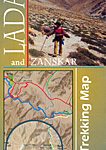
Ladakh and Zanskar North: Brog-Yul – Nubra – Shyog
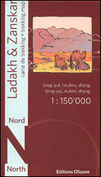
Northern Ladakh and Zanskar: Brog-Yul – Nubra – Shyog area at 1:150,000 in a series of excellent topographic trekking maps from the Geneva based Editions Olizane on light, waterproof and tear-resistant plastic paper. Each map is double-sided, covering a large area of 90km x 240km. The maps have exceptionally clear cartography with contours at 100m intervals, enhanced by relief shading, additional spot heights for peaks and passes, plus colouring indicating glaciers, marshes, protected zones and forested or cultivated areas. Population centres are graded into towns, villages, hamlets and settlements and names of local regions are shown.Roads, tracks and numerous trails are clearly highlighted and symbols indicate various places of interest: forts, palaces and ruins, religious sites, old trade routes, caves and hot springs, checkpoints and military posts, etc. The maps have a UTM grid and latitude/longitude margin ticks at intervals of 9’. Map legend in English and French. Also provided is a glossary of geographical and cultural local terms.

Related Products:
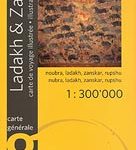
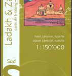 Ladakh & Zanskar South – Upper Zanskar – Rupshu Editions Olizane
 India: Ed. Olizane Trekking Maps of Ladakh and Zanskar
 Ladakh – Zanskar Nelles
 Ladakh & Zanskar Olizane Illustrated Travel Map
 Leh, Zanskar and Nubra Valley
 Ladakh and Zanskar Trekking Map
 North Island – Northern & Central Kiwimaps
 Hanoi – Vietnam North ITMB
 Alsace – Vosges North – Hagenau – Starsburg 2-Map Set Kompass 2220
 South Island – Northern & Central Kiwimaps
 Mallorca North Reise Know-How
 South America North ITMB
 North Island – Eastern & Southern Kiwimaps
 Palmerston North Pathfinder
 Italy North K+F Road Map
 North Macedonia F&B Top 10 Tips
 China North-West Wall Map
 Poland North
 Montenegro F&B
 Wellington – Wairarapa: Palmerston North, Levin, Masterton
 North Westland: Westport, Reefton, Greymouth, Hokitika
 Far North: Cape Reinga, Kaitaia, Kerikeri, Whangarei
 Aruba
Aruba
 Hawke`s Bay: Taupo, Napier, Hastings, Palmerston North
 Kilimanjaro & Tanzania North ITMB
 North Annapurna Base Camp
 Northern Ireland: OSNI 25K Activity Maps
 Spain North – Santiago Route Reise Know-How
 Italy North Reise Know-How
 Kurzeme North Jana Seta Tourist Map
 Sweden North – Ostersund F&B
 Vidzeme North Jana Seta Tourist Map
 Vietnam North NGS Adventure Map 3015
 Shivapuri Nagarjun National Park
 Vidzeme East – Latgale North Jana Seta Tourist Map
Galway County
Vidzeme East – Latgale North Jana Seta Tourist Map
Galway County
 Cape Peninsula
 Japan North & Hokkaido ITMB
 Bavaria North – Saxony – Thuringia K+F Regional Road Map