Disclosure : This site contains affiliate links to products. We may receive a commission for purchases made through these links.
La Gomera Kompass 231
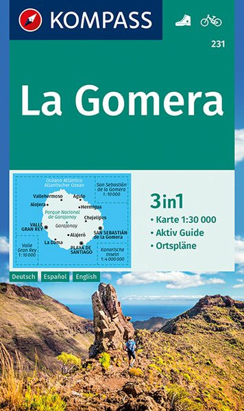
La Gomera in a series of maps of the Canary Islands from Kompass, Europe’s leading publisher of detailed, contoured hiking maps. Excellent also for exploring each island on bike or by car, the maps highlight numerous hiking trails, indicating difficult sections, and show cycle routes. A wide range of symbols highlight various facilities and places of interest, including campsites and youth hostels, beaches, sport and leisure facilities, etc. The maps have a UTM grid for GPS users. Map legends included English. Street plans of main towns or holiday resorts are also provided.*In this title:* contour lines are at 50m intervals, with relief shading, spot heights and plenty of names of peaks, mountain ranges and other geographical features. Boundaries of the national park and other protected areas are marked. Overprint for hiking trails indicates steep sections and paths suitable mostly for experienced climbers. Local bus stops are marked. The map has a UTM grid. Street plan shows San Sebastiรกn de la Gomera.The map comes with an illustrated booklet, in German only, describing the main sights. The booklet is not available in English edition.PLEASE NOTE( (22.9.2011): following the changes during 2011 in the road numbering on the island from TF to GM numbers, this title does not yet show TF711 and TF713 as GM1 and GM2 respectively. Other roads, due to be re-numbered during 2011, are not numbered on the map.

Related Products:
 La Gomera F&B
 Gran Canaria Kompass 237
 Tenerife Kompass 233
Fuerteventura Kompass 240
Tenerife Kompass 233
Fuerteventura Kompass 240
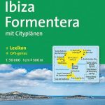 Ibiza – Formentera Kompass 239
 Spain: Kompass Maps of the Canary Islands
 Spain: Kompass Maps of the Balearic Islands
 Garajonay National Park – Gomera CNIG Map-Guide SPANISH
 Garajonay National Park – Gomera CNIG Map-Guide ENGLISH
 Malta – Gozo Kompass 235
 Istria Kompass 238
 Bornholm Kompass 236
 La Palma Kompass 232
 Aeolian (Lipari) Islands Kompass 693
 Trentino 3-Map Set Kompass 683
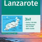 Lanzarote Kompass 241
 Spessart 2-Map Set Kompass 832
Mecklenburg Lake District 3-Map Set Kompass 865
Spessart 2-Map Set Kompass 832
Mecklenburg Lake District 3-Map Set Kompass 865
 Gomera CNIG Topo 1095-1101
 Madeira Kompass 234
 Walk! La Gomera
 San Sebastian de la Gomera 25K CNIG Topographic Survey Map No. 1101-II
 Regglberg – Latemar – Val d`Ega / Eggental Kompass 630
 La Gomera & El Hierro Tour & Trail Super-Durable Map
Mountain Route Odenwald-Neckar Valley 2-Map Set Kompass 827
Westerwald – Siegen – Lahn-Dill-Bergland NP 2-Map Set Kompass 847
La Gomera & El Hierro Tour & Trail Super-Durable Map
Mountain Route Odenwald-Neckar Valley 2-Map Set Kompass 827
Westerwald – Siegen – Lahn-Dill-Bergland NP 2-Map Set Kompass 847
 Elba Kompass 2468
 Lake Constance 2-Map Set Kompass 11
 Juist Kompass 728
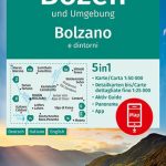 Bolzano and Environs Kompass 54
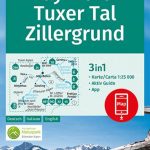 Mayrhofen – Tuxer Tal – Zillergrund Kompass 037
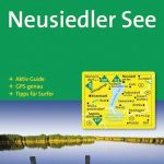 Neusiedler See Kompass 215
 Flensburg – Kappeln Kompass 707
 Seefeld in Tirol – Leutasch Kompass 026
Stubai Alps Kompass 83
Seefeld in Tirol – Leutasch Kompass 026
Stubai Alps Kompass 83
 Saarland 2-Map Set Kompass 825
Starnberger See Kompass 793
Saarland 2-Map Set Kompass 825
Starnberger See Kompass 793
 Rรผgen Kompass 737
Venedigergruppe – Oberpinzgau Kompass 38
Defereggental – Villgratental Kompass 45
Rรผgen Kompass 737
Venedigergruppe – Oberpinzgau Kompass 38
Defereggental – Villgratental Kompass 45