Disclosure : This site contains affiliate links to products. We may receive a commission for purchases made through these links.
La Alpujarra and La Costa Editorial Penibetica
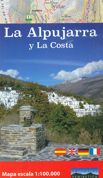
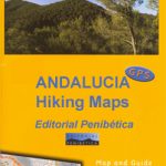
The Alpujarra region of Andalucรญa on an indexed, contoured map at 1:100,000 from Editorial Penibetica, extending from the coast between Motril and Roquetas de Mar across southern slopes of the Sierra Nevada to its peaks including Mulhacรฉn. On the reverse are multilingual descriptions and photos of various places of interest.Coverage extends along the coast from just west of Motril, past Roquetas de Mar, to Castell del Rey near Almerรญa, and inland to the Puerto de la Ragua pass to include Mulhacรฉn and the highest peaks of the Sierra Nevada. Topography of this mountainous region is shown by contours at 100m intervals, relief shading and altitude colouring, with names of peaks, valleys, etc, and boundaries of protected areas. Road network includes small local roads and indicates locations of petrol stations. The map highlights the course of the GR7 and other long-distance routes, and indicates sites with the shorter PR and SL trails. Icons show campsites and mountain refuges, sites for recreational activities such as climbing, canyoning, kayaking, etc. The map is indexed but has no geographical coordinates.On the reverse are notes about the region and its sights, illustrated with colour photos. Map legend and all the text include English.

Related Products:
 Sierra Nevada – the Alpujarra – Marquesado del Zenete Editorial Penibetica Map and Guide
 Sierra Nevada – La Alpujarra Editorial Alpina
 Sierra Nevada – the Traverse at 3000m Editorial Piolet
 Sierra de Segura Editorial Penibetica
 Gibraltar – Costa del Sol
 Sierra de las Nieves Natural Park Editorial Penibetica Maps and Guide
 Sierra de Cazorla – Sierra de Castril Editorial Penibetica
 Sierra de Grazalema Editorial Penibetica
 Sierra de Huetor Natural Park Editorial Penibetica SPANISH
 Sierra de Cazorla Editorial Penibetica
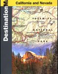 Sierra Nevada Destination Map
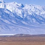 Highway 395 – Carson City NV to Lone Pine CA Benchmark Road Map
 Andalucia – Costa del Sol – Seville – Cordoba – Granada Marco Polo Map
 Sierra Tarahumara
 Costa Blanca – Valencia – Alicante – Castellon – Murcia Marco Polo Map
 Sierra Espuรฑa – Barrancos de Gebas – La Muela Editorial Piolet
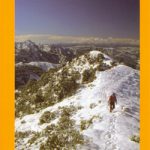 Sierra Nevada Mountain Guidebook
 Sierra Nevada – Las Alpujarras CNIG Map
 Pyrenees 350K Editorial Alpina Road Map
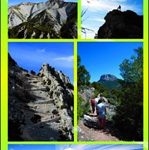
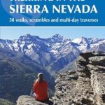 Walking and Trekking in the Sierra Nevada: 38 walks, scrambles and multi-day traverses
 Costa del Maule
 El Turbรณn ‘“ Alto Valle de Isรกbena Editorial Alpina
 Catllarร s – Picancel Editorial Alpina
 Costa Rica Borch
 Congost de Mont-rebei Editorial Alpina
 Valles de Irati y Aezkoa Editorial Alpina
 Torcal de Antequera – Lagoons Fuente de Piedra, Campillos, Ratosa & Archidona Editorial Penibetica SPANISH
Torcal de Antequera – Lagoons Fuente de Piedra, Campillos, Ratosa & Archidona Editorial Penibetica ENGLISH
Torcal de Antequera – Lagoons Fuente de Piedra, Campillos, Ratosa & Archidona Editorial Penibetica SPANISH
Torcal de Antequera – Lagoons Fuente de Piedra, Campillos, Ratosa & Archidona Editorial Penibetica ENGLISH
 Valles de Ansรณ & Echo Editorial Alpina
 Valle de Canfranc – Valle de Aisa – Candanchu – Astun Editorial Alpina
Vall de Barravรฉs – Ribagorรงa Editorial Alpina
Valle de Canfranc – Valle de Aisa – Candanchu – Astun Editorial Alpina
Vall de Barravรฉs – Ribagorรงa Editorial Alpina
 Sierra Crestellina – Sierra de la Utrera Birding Map
 Granada & Sierra Nevada
Val d`Aran – Mauberme – Montardo – Molieres Editorial Alpina
Val d`Aran by UTMB Editorial Alpina Trail running race Map
Granada & Sierra Nevada
Val d`Aran – Mauberme – Montardo – Molieres Editorial Alpina
Val d`Aran by UTMB Editorial Alpina Trail running race Map
 Valles de Belagua y Roncal Editorial Alpina
 Costa Blanca
 Montgrony – Fonts del Llogregat – Parc Natural del Cadรญ-Moixerรฒ Editorial Alpina
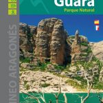 Sierra y Canones de Guara Editorial Alpina